11.9 Miles
2142 feet
Palomino Mountain
A++++ Views
The Best Part?
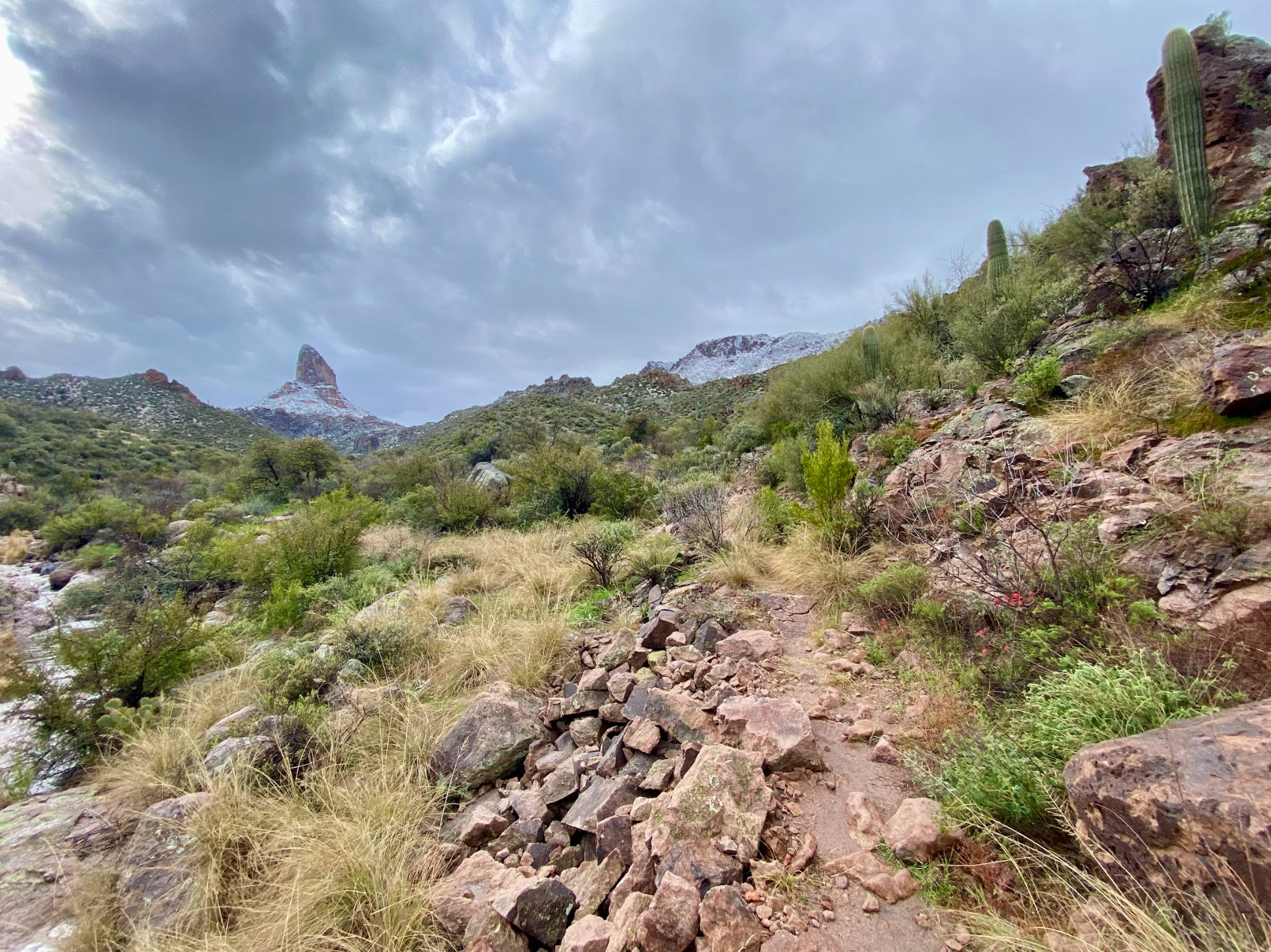
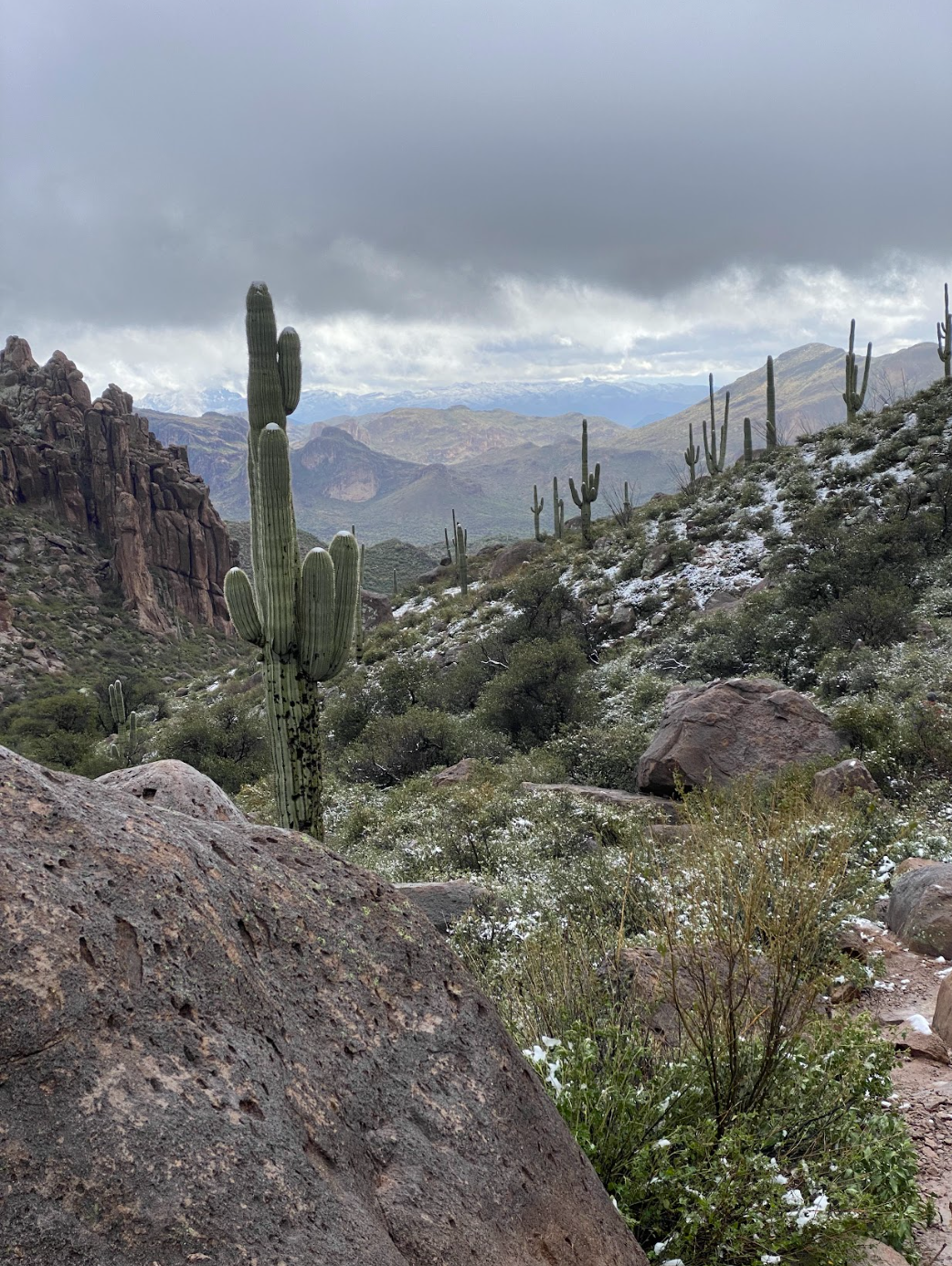
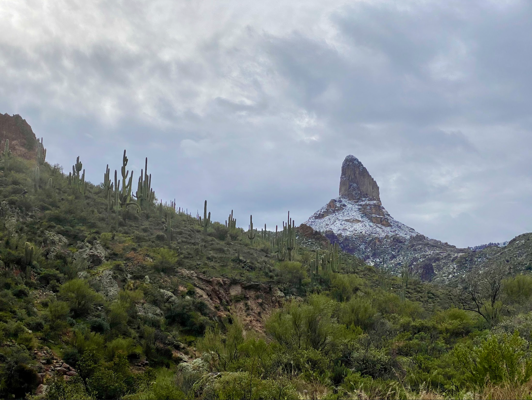
Snow in the Desert!
What did I learn?
Orient Tent Perpendicular to Wind
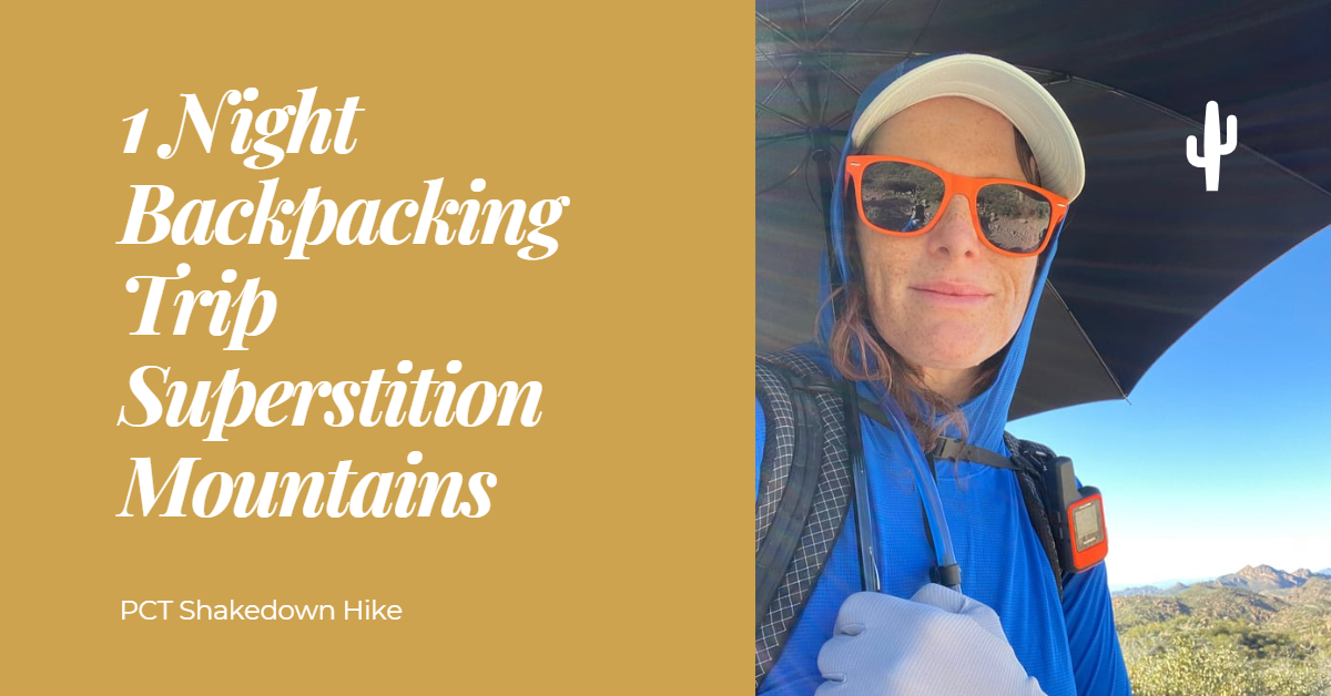
1 Night Backpacking Trip Superstition Mountains Overview
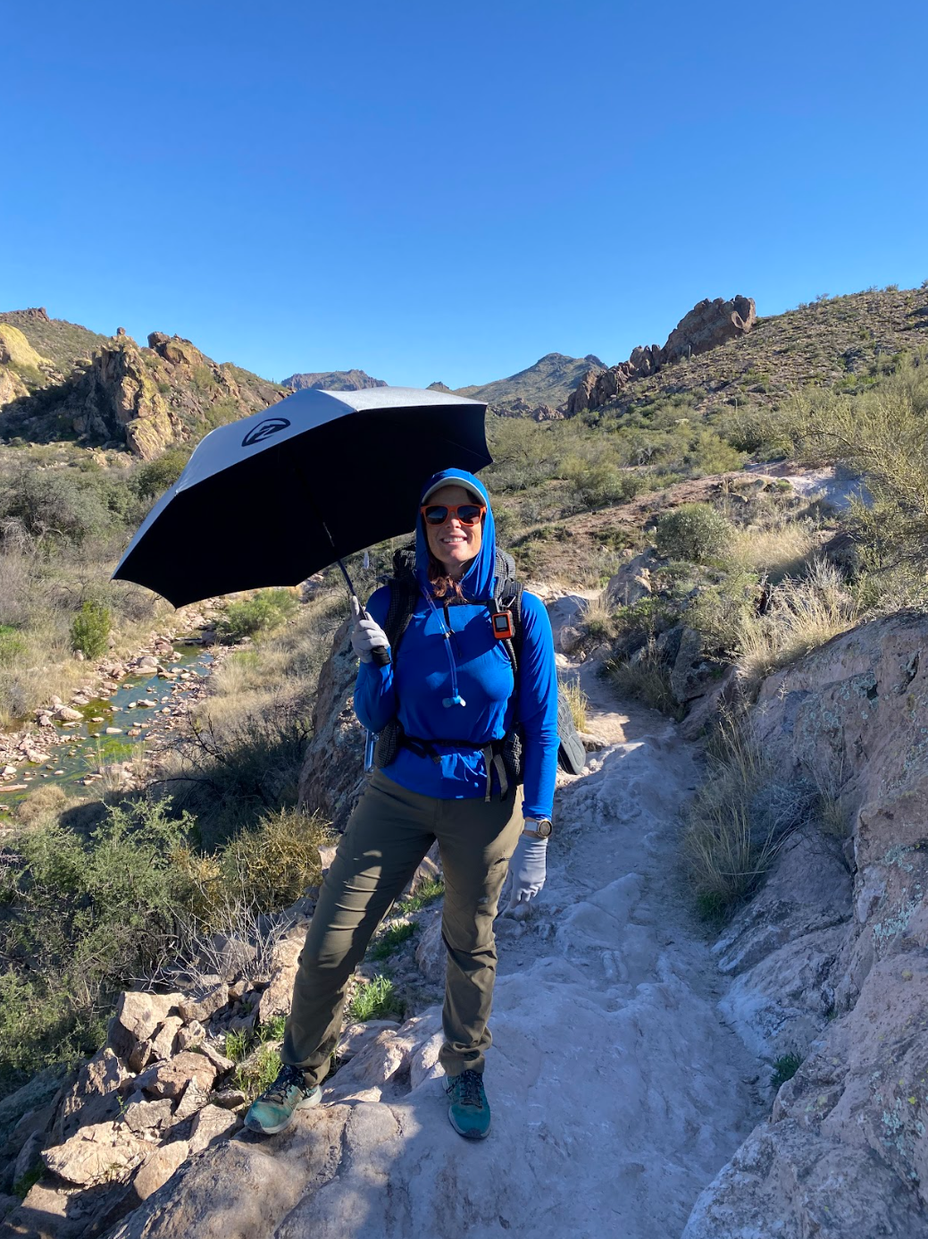
I woke up on February 25th and really wanted to go backpacking. I was itching to test my PCT gear! My significant other and in-laws agreed to drop me off at 1st water trailhead and pick me up the next day at the Peralta Trailhead. There was a storm coming in overnight and I thought great opportunity to test my gear.
It ended up snowing and it was one of the most magical experiences EVER. You know those really sweet photos of cacti/the desert blanketed in snow? I got to hike in that!
Trail Journal
✨3 Things I’m Grateful For
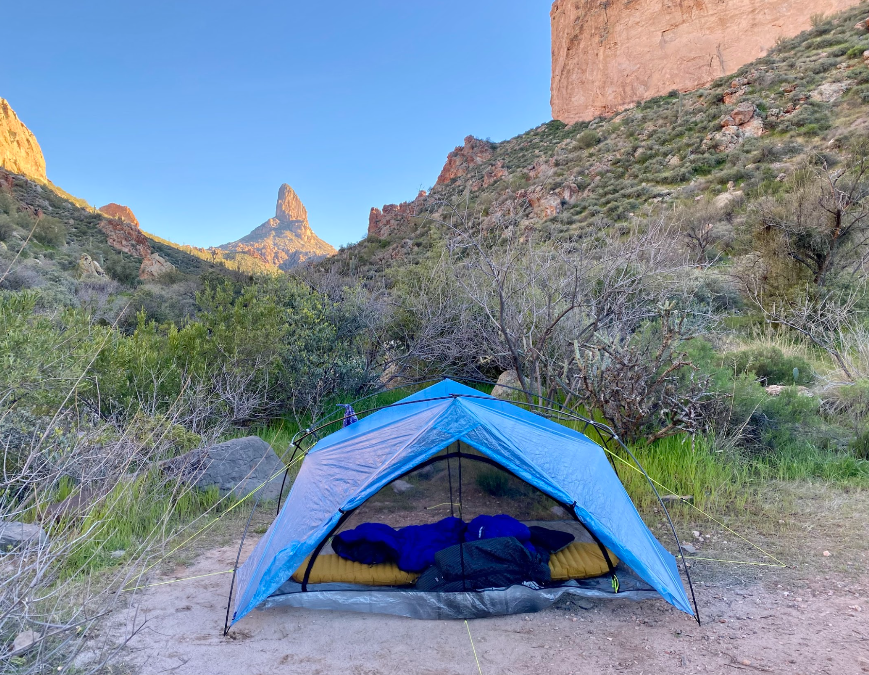
1. My new Zpacks tent keeping me dry!
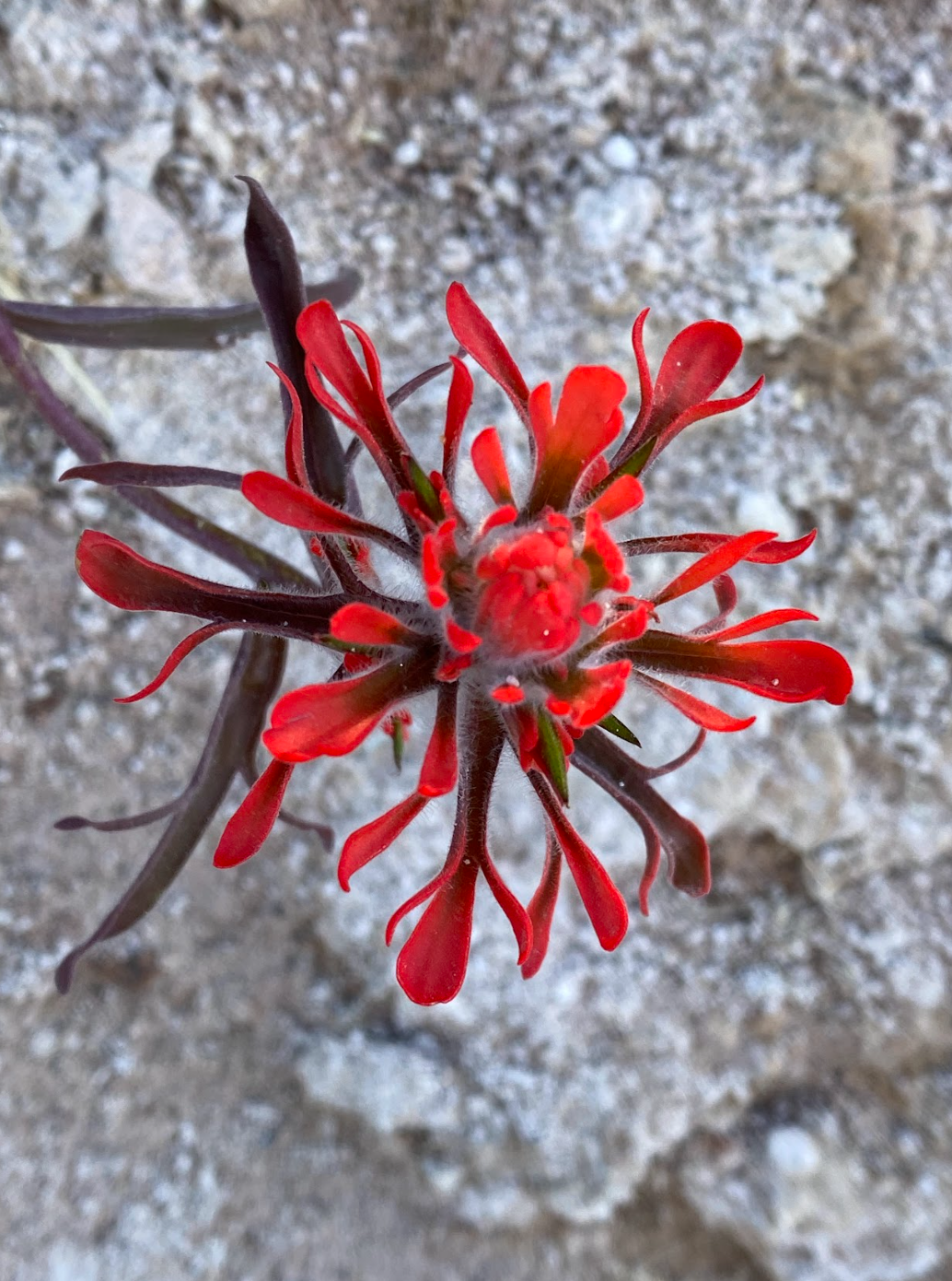
2. All the wildflowers 🌼
3. Being able to just wake up and decide I want to go backpacking that night
✨3 Things I’m Excited About
1. Thru-hiking the PCT (my extended backcountry vacation)!
2. Getting to spend more time outdoors
3. Figuring out my trail food
✨How did my Body Feel?
Right neck and shoulder were pinching while wearing my pack. My left hip was not happy coming down from Fremont Saddle.
✨How was my food situation?
I packed in a Little Miss BBQ burrito for dinner and it was fantastic (of course!). My healthy oatmeal was disgusting. I will add sugar to future iterations to make sure it tastes good. Overall, I had enough food and felt well-fueled.
✨What did I learn and how will I take action?
1. My tent performs best when it is perpendicular to the wind direction (less flapping when there are big gusts). Because of the way the doors overlap, the outermost door needs to be in the same direction as the wind. When selecting campsites, I should try to predict the wind direction and pitch accordingly.
2. Bring a rag to wipe things down!
Photo Gallery to Inspire you to Hike in the Superstitions


Map & Elevation Profile
Max elevation: 2683 ft
Min elevation: 2259 ft
Total time: 02:15:42
Max elevation: 3789 ft
Min elevation: 2342 ft
Total time: 03:05:14
Map for Hiking in the Superstition Mountains
The trail is well marked but you never know when you might want to look at a map! And this map is excellent.
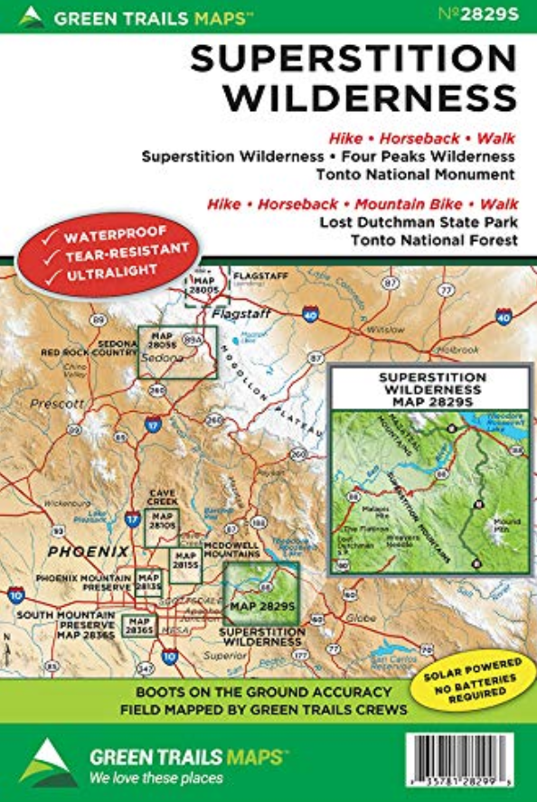
Superstition Mountains Greentrails map
You definitely won’t regret having this map for your Superstition Mountain hikes (affiliate link)!
Parking
Put int “first water trailhead” into your GPS. It will want you to select the horse lot or heli spot. Either is fine. You will drive past these to the end of the dirt road. There is plenty of parking! The road may be in bad condition. You won’t need 4WD, but high clearance may be necessary.
Similar process for the Peralta Trailhead. Keep in mind it is on a maintained dirt road and can get washed out or be in bad condition. Any high-clearance vehicle will be fine!
1 Night Backpacking Superstition Mountains Notes
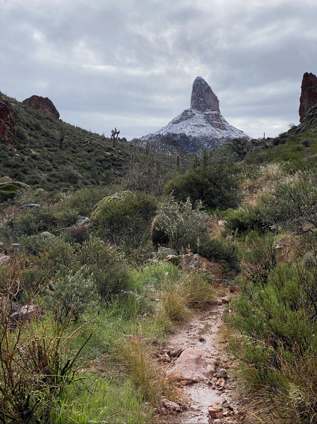
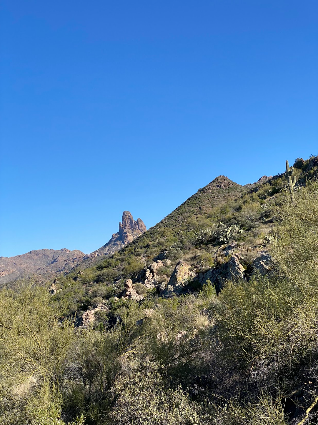
For this trip, I headed down the connector trail from the parking lot and turned right on the Dutchmans trail. You will cross rivers, see cool rocks and the microclimates they create, and Weaver’s Needle pop in and out. In 4 ish miles, you will hit Parker Pass and it’s gorgeous! There are great views all around. I was out during wildflower season and they were everywhere!
You will start to descend and a few camping spots will start popping up. These are great spots but may not be near water. I saw a ranger and he recommended camping at the base of Palomino Mountain. The trail will flatten out and you pass the Black Mesa, Boulder Canyon, and Bull Pass intersections. Just past the Bull Pass intersection are 2 great sites! They are right by water (if it recently rained) and have great views of Weaver’s Needle. They are right on the trail but the traffic is low back there 🙂.
The weather forecast didn’t lie. A storm came in and it started raining/snowing at 3 am. My tent was in a mud puddle but I was completely dry on the inside. It was so cool to look outside in the morning and see snow on the surrounding mountains!
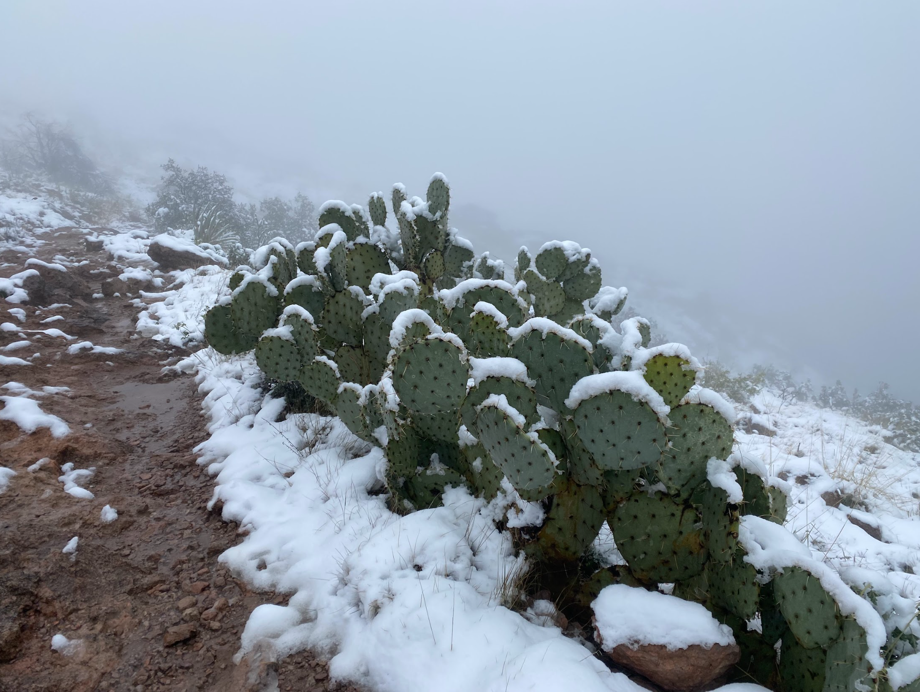
It stopped raining around 10 and I packed up to hike out to the Peralta Trailhead. The trail was a wet slushy mess with streams and waterfalls. But it was gorgeous! It rained a hailed a bit but it felt so special to be back there in the snow.
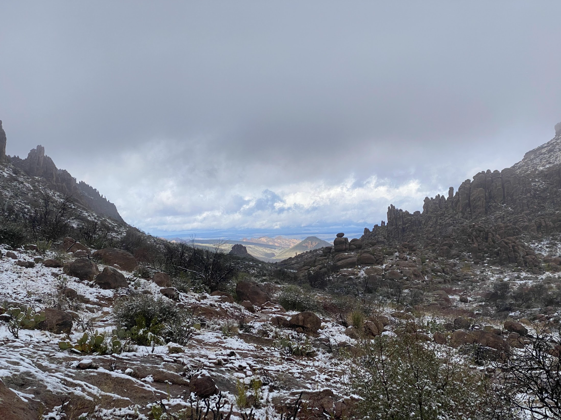
I hiked 7 miles out via the Peralta Trail. You climb up for 1600-ish ft of elevation right next to Weaver’s Needle. There are some really sweet campsites I would love to come back to camp in. There was more and more snow and luckily someone hiked before me. I followed this person’s tracks all the way up to the Fremont Saddle.
The path down to the parking lot was a little treacherous with the snow but also really beautiful.
The snow made for a great unique experience!
There was water everywhere but I did this trip in 2023 when we had a crazy amount of rain. Be careful about the water situation and the amount of precipitation when you go!
So, should you do this backpacking trip?
100%. It is desert hiking at its finest and is absolutely stunning. Definitely worth day hiking as well!