2.8 Miles

140 feet

Pretty Easy

A+ Views

Walkin’ Jim Trail Hike Overview

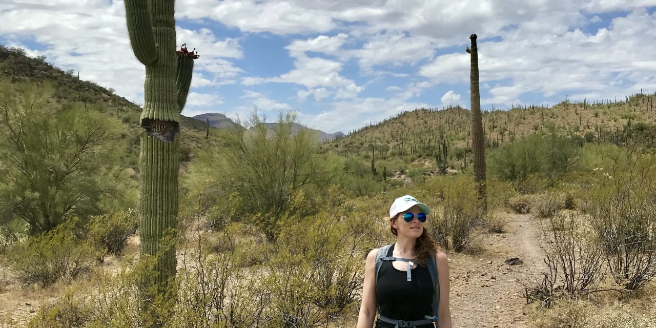
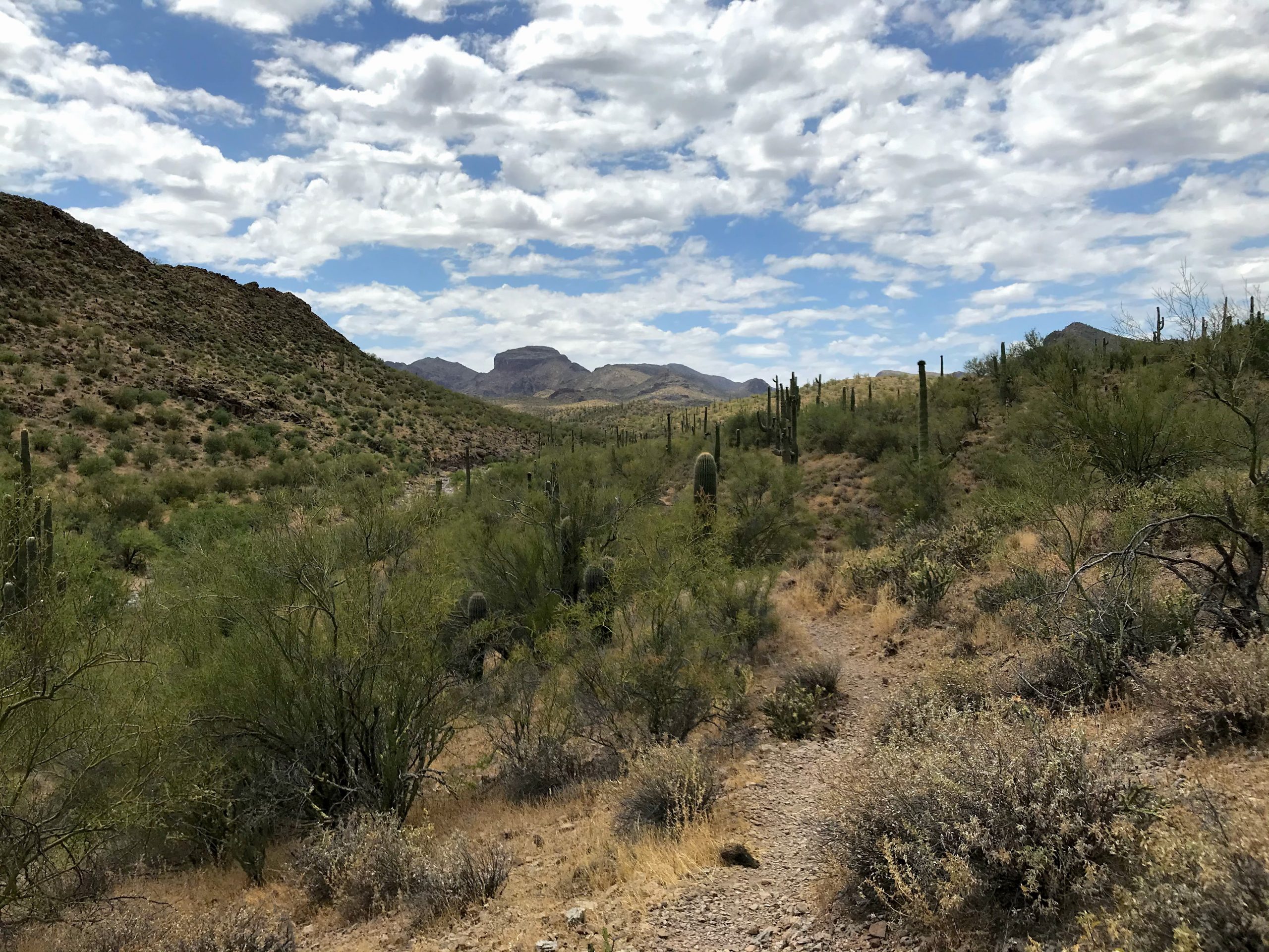
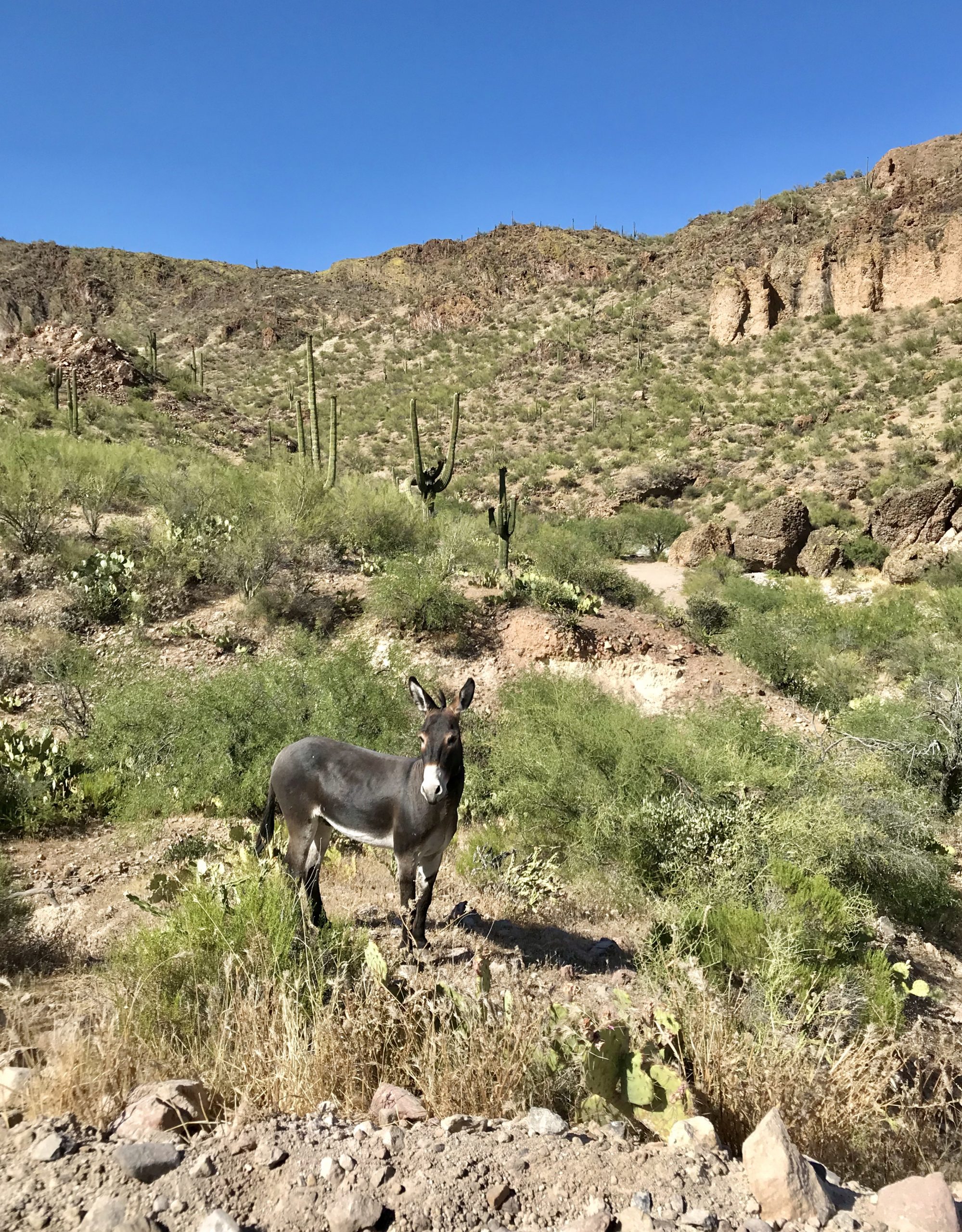
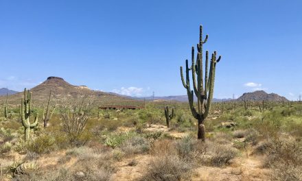
The Walkin’ Jim Trail hike excels at solitude, views, Staghorn cholla, and wild burros. This is an excellent trail close to Lake Pleasant. Do yourself a favor and hike this!

Map & Elevation Profile

Total distance: 2.78 mi
Max elevation: 1877 ft
Min elevation: 1783 ft
Total time: 01:10:13

Map for the Walkin’ Jim Trail

Alltrails has a great map of this hike for you. Check it out here.

Parking

From the W Carefree Highway (74), turn on N Castle Hot Springs Road. 2.3 miles from the turnout to Scorpion Bay, you will see gravel parking lots on both sides of the road. The Walkin’ Jim Trail Hike starts from the northwest corner of the lot on the right-hand side of the road. There is a gate that you will need to unlatch and walkthrough.

Walkin’ Jim Trail Hike Notes

On this day we planned to drive to Crown King to off-road in the Bradshaw mountains. However, I17 didn’t want us to do that. There was a brush fire earlier in the day the traffic was backed up for miles.

We looked at a map and said let’s go towards Wickenburg to avoid the traffic. I randomly found this article from a Scorpion Bay rental company about the best hikes in the area and am so glad I did!

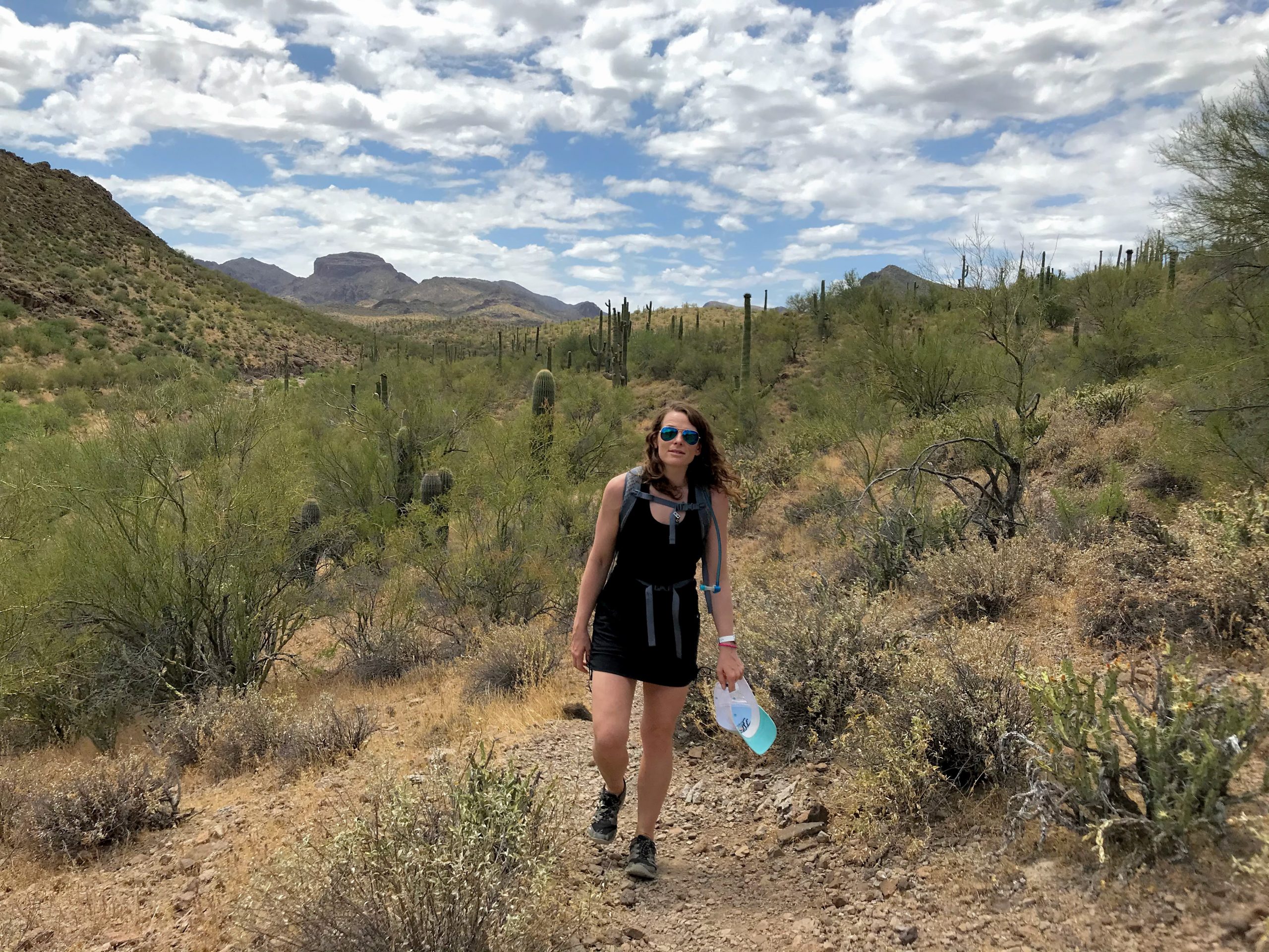
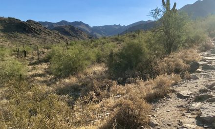
The Walkin’ Jim Trail turned out to be awesome. This type of trail is exactly what I l think of when I think of a ‘real hiking trail.’ It’s hard to describe but think a single wide gravel/rocky path that weaves in and out and up and down washes. Sometimes you are in the creek bed, sometimes you are next to it. And there are cairns.

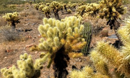
There were also great mountain views, a gazillion Staghorn cholla (learn more about the different types of cholla in this great video tutorial), and wild burros. It was neat to see the burros but also worth mentioning that there was a lot of burro poop. And I mean A LOT. It was sort of impressive how much poop there was. But if you hike around where burros live you are bound to see poop.

It was really hot when we were there and we only hike 3 miles total. You can turn this into a shorter or longer loop.

So, is the Walkin’ Jim Trail Hike worth it?

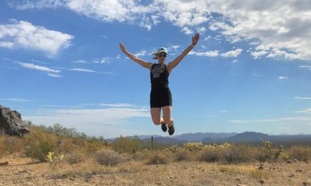
We are 100% going back here when it isn’t so hot. This is a fantastic area! We will be back Walkin’ Jim Trail!

Photos that will make you want to go there:

Get more inspired to get outside:

PCT Trail Journal: Day 14 Mile 146.1 to Paradise Valley Cafe (Mile 151.8)

6.21909 up873 downIdyllwild Airbnb151.82 Hours 4 MinutesIdyllwild and town food!I start out with big hunger and then can't eat everythingPCT Trail Journal: Day 14 Mile 146.1 to Paradise Valley Cafe (Mile 151.8) On day 14 of the PCT (mile 146.1 to Paradise Valley...

PCT Trail Journal: Day 13 Miles 131.6 to 146.1

15.612405 up2336 downMile 146.1146.16 Hours 11 MinutesThe wildflowers 🌼🌼🌼Need larger battery pack ASAP!PCT Trail Journal: Day 13 Miles 131.6 to 146.1 Miles 131.6 to 146.1 on the PCT were good and hot filled with more wildflowers than you could imagine. There was a lot...

PCT Trail Journal: Day 12 Miles 115.4 to 131.6

16.033291 up1906 downMile 131.6131.65 Hours 50 MinutesListening to my book while hikingI am quite dirty. So dirty that bandaids and tape won't stick to my skin. PCT Trail Journal: Day 12 Miles 115.4 to 131.6 Miles 115.4 to 131.6 were both hard and gave me a sense of...

PCT Trail Journal: Day 11 Miles 104.8 to 115.4

13.531519 up1513 downMile 115.4115.44 Hours 56 MinutesWalking through field after field of wildflowers I don't need 10 bars per day and should focus on the base meals in resupply boxesPCT Trail Journal: Day 11 Miles 104.8 to 115.4 Miles 104.8 to 115.4 on the PCT were...

PCT Trail Journal: Day 10 3rd Gate Water Cache to Mile 104.8 (Miles 91.2 to 104.8)

13.631558 up1611 downMile 104.8104.84 Hours 27 MinutesThe wildflowers and trail magic!Trail magic is awesome but I already knew that. I need to take more breaks and do shorter days. PCT Trail Journal: Day 10 3rd Gate Water Cache to Mile 104.8  Day 10 from 3rd Gate...

PCT Trail Journal: Day 9 Scissors Crossing to 3rd Gate Water Cache (Mile 77.1 to 91.2)

14.012211 up1043 down3rd Gate Water Cache91.24 Hours 57 MinutesThe trail and finding new hiking friends!I drink a lot of water. Need to be smart about water sources especially in these drier sections.PCT Trail Journal: Day 9 Scissors Crossing to 3rd Gate Water Cache ...

PCT Trail Journal: Day 7 & 8 Double Rest Day at Stagecoach

00 up0 downSheep Shed @ Stagecoach RV Resort76.30Day 7: Having a chill day at Stagecoach and getting new shoes! Day 8: Hanging in Julian with Hannah, Jorrit and Liam 💗Day 7: Use padded moleskin around a blister to relieve some of the pressure on the blister Day 8:...

PCT Trail Journal: Day 6 mile 68.4 to Stagecoach RV Resort (mile 68.4 to 76.3)

7.85738 up 2231 downStagecoach RV Resort76.33 hours 7 minutesThe best part was that it was a good day  Taking it easy is good for me.PCT Trail Journal: Mile 68.4 to Stagecoach RV Resort (mile 68.4 to 76.3) Town day means wake early and hike day. Your girl was up...

PCT Trail Journal: Day 5 Mile 56.2 to 68.4

12.341247 up 2759 downMile 68.468.45 hours 2 minutes⛰Nice sections of trail with great mountain views 🌼Lots of wildflowers as I got lower    Feet must be fixedPCT Trail Journal: Mile 56.2 t0 68.4 Overview Wow super rough day. My feet are in terrible shape....

PCT Trail Journal: Day 4 Mt Laguna to Mile 56.2 (Miles 48.7 to 56.2)

15.001837 up2526 downMile 56.256.25 hours 55 minutesThe section of the trail past the picnic area on the edge of a mountain with great desert views  ✨Need to take better care of my feet✨Need to take breaksPCT Trail Journal: Mt Laguna to Mile 56.2 (Miles 48.7 to...