7.8 Miles

1,512 feet

Pretty Hard

A+ Views

Bell Pass Hike Overview

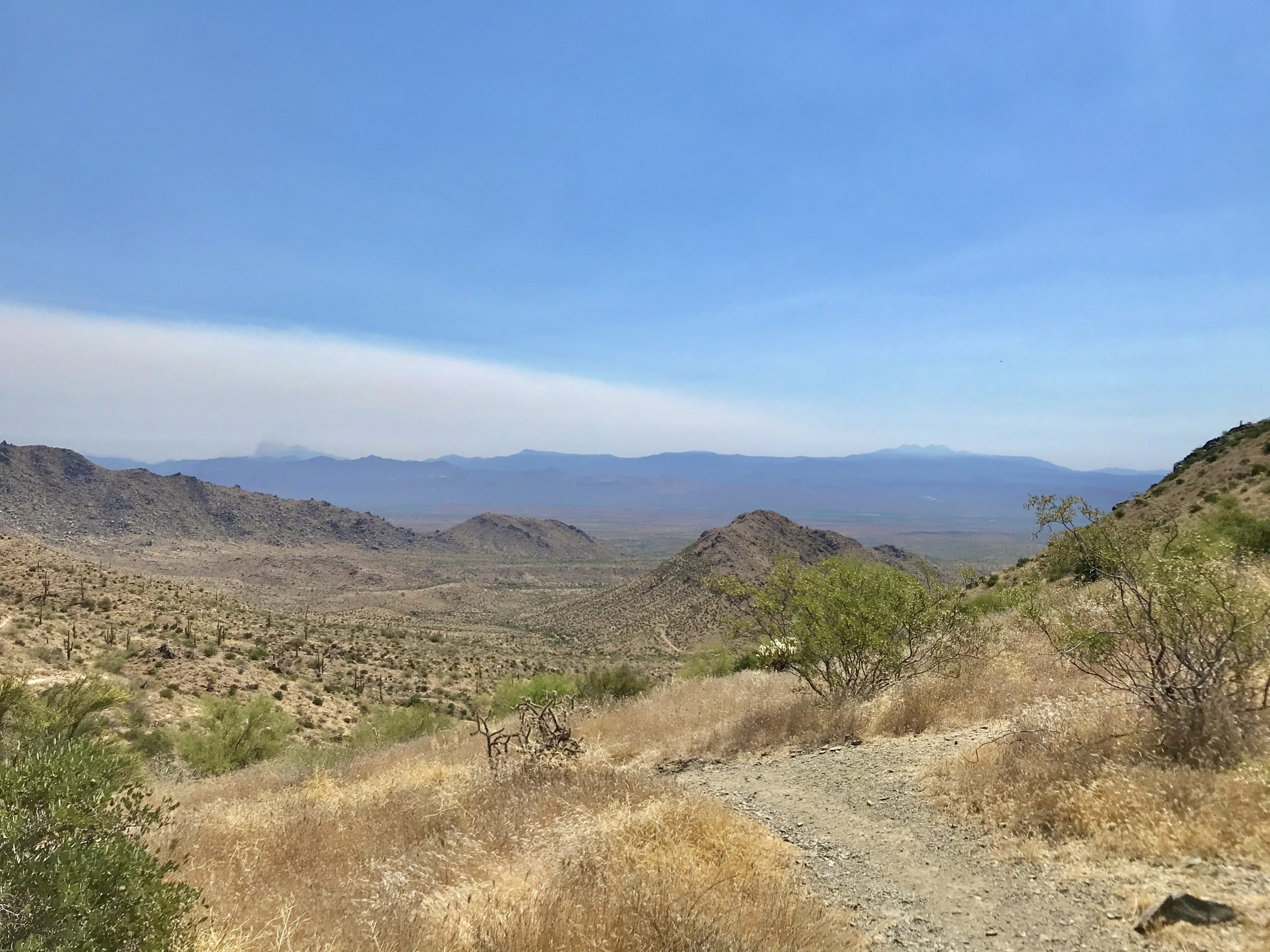
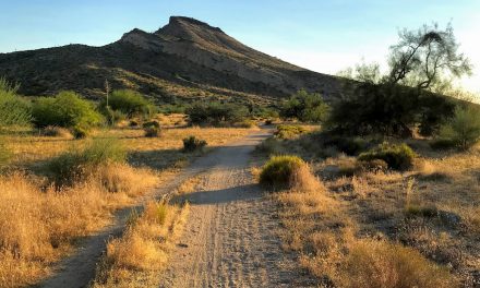
The Bell Pass hike is pretty tough, especially if it’s hot out. It is up all the way until the pass, with the last 0.5 miles being pretty steep. The views are excellent. This is McDowell Sonoran Preserve hiking at it’s finest! 

Map & Elevation Profile

Total distance: 7.85 mi
Max elevation: 3226 ft
Min elevation: 1714 ft
Total time: 02:33:19

Map for the Bell Pass Hike

Get this map! The Green Trail Maps are super nice maps because they are easy to read, have good color coding, distances and elevations, and are usually up to date.

mcdowell mountains green trails map get outdoors get happy

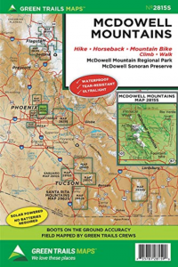
McDowell Mountains Greentrails map

You definitely won’t regret having this map for your McDowell Sonoran Preserve hikes!

Parking

Plug in ‘gateway trailhead’ and Google maps will take you right there. Parking is free and there’s lots of it!

Bell Pass Hike Trail Notes

The Bell Pass hike was a lot harder than I imagined. In my mind, I would be doing a moderate hike to an area of the McDowells that I haven’t visited yet.

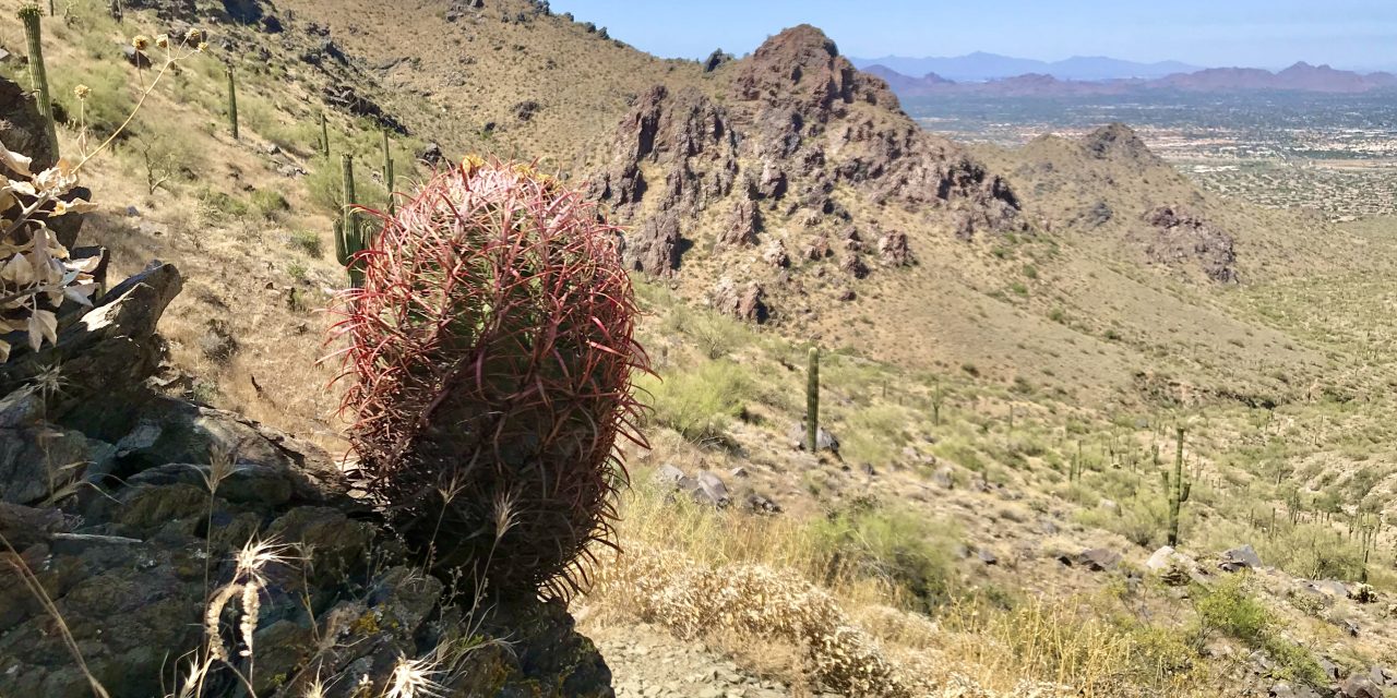
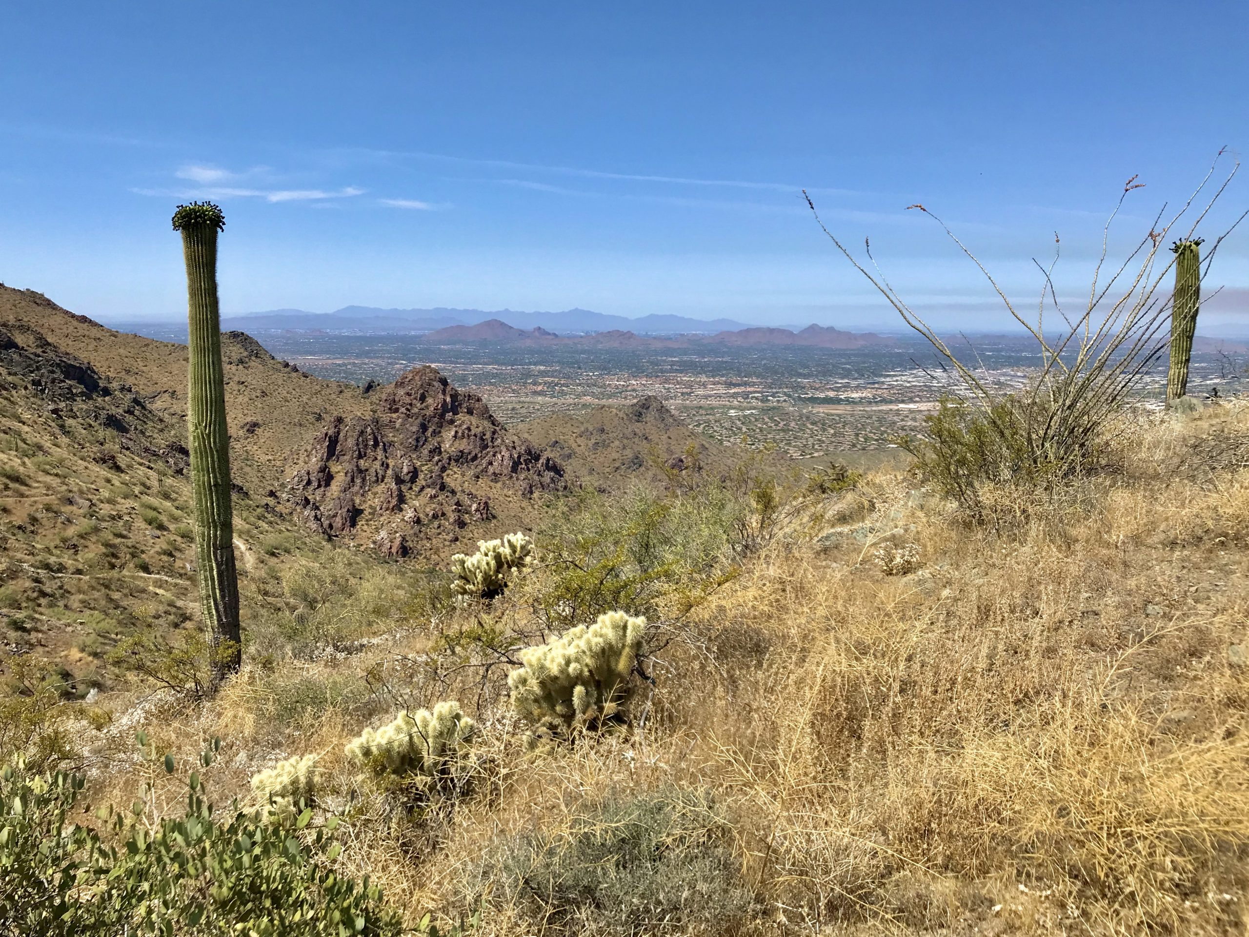
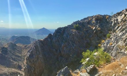
After arriving later than intended (8:45 am), it was already 90f. The first part on the Gateway trail is easy going. It’s a rocky trail with a gradual incline. After turning off onto the Bell Pass trail it starts to climb. By the last mile, it really starts to climb. During the last half mile, I was on the struggle bus! It gets steeper and steeper as you approach the pass. There is a bonus though. Every time you need to stop to catch your breath you get to look at great views of Camelback, Piestewa, Estrellas, the Whitetanks, Lookout, and more. When high enough you can even see downtown Phoenix!

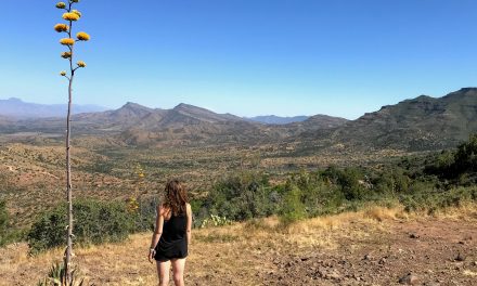
At the pass, you are greeted by wonderful views. The Tonto National Forest and the Four Peaks on one side and Phoenix and it’s glorious mountains on the other.

I cannot wait to do the Bell Pass hike and get to spend time up at the pass. The views are amazing! While up there, I fantasized about how in the winter I am going to take the whole day to do the big loop through Windgate pass.

While at the pass, I noticed that I only had about half a liter of water left (started with 3 liters). This is not enough and I should have brought more. After hiking and camping a bunch in West Texas and Big Bend, I learned this good rule of thumb that should have applied here to this hike:

When hiking in the desert, double whatever amount of water you think you need. You always end up needing more than you think!

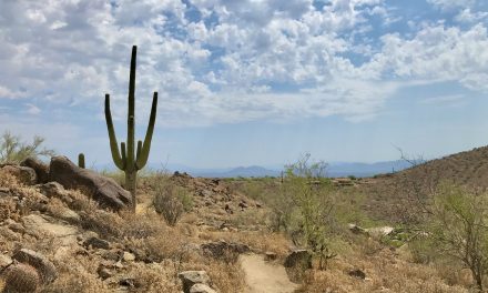
The views heading back down are great. Be prepared for a knee buster!

So, is the Bell Pass hike worth it?

Yes! I definitely want to hike it again when the weather is cooler.

Other hikes close by

Also starting from this trailhead is the Gateway Loop hike. It’s shorter with not so much elevation and tons of great views. For something more chill, mosey on up to the Fraesfield trailhead and try the Whiskey Bottle Trail hike.

Get more inspired to get outside:

PCT Trail Journal: Day 14 Mile 146.1 to Paradise Valley Cafe (Mile 151.8)

6.21909 up873 downIdyllwild Airbnb151.82 Hours 4 MinutesIdyllwild and town food!I start out with big hunger and then can't eat everythingPCT Trail Journal: Day 14 Mile 146.1 to Paradise Valley Cafe (Mile 151.8) On day 14 of the PCT (mile 146.1 to Paradise Valley...

PCT Trail Journal: Day 13 Miles 131.6 to 146.1

15.612405 up2336 downMile 146.1146.16 Hours 11 MinutesThe wildflowers 🌼🌼🌼Need larger battery pack ASAP!PCT Trail Journal: Day 13 Miles 131.6 to 146.1 Miles 131.6 to 146.1 on the PCT were good and hot filled with more wildflowers than you could imagine. There was a lot...

PCT Trail Journal: Day 12 Miles 115.4 to 131.6

16.033291 up1906 downMile 131.6131.65 Hours 50 MinutesListening to my book while hikingI am quite dirty. So dirty that bandaids and tape won't stick to my skin. PCT Trail Journal: Day 12 Miles 115.4 to 131.6 Miles 115.4 to 131.6 were both hard and gave me a sense of...

PCT Trail Journal: Day 11 Miles 104.8 to 115.4

13.531519 up1513 downMile 115.4115.44 Hours 56 MinutesWalking through field after field of wildflowers I don't need 10 bars per day and should focus on the base meals in resupply boxesPCT Trail Journal: Day 11 Miles 104.8 to 115.4 Miles 104.8 to 115.4 on the PCT were...

PCT Trail Journal: Day 10 3rd Gate Water Cache to Mile 104.8 (Miles 91.2 to 104.8)

13.631558 up1611 downMile 104.8104.84 Hours 27 MinutesThe wildflowers and trail magic!Trail magic is awesome but I already knew that. I need to take more breaks and do shorter days. PCT Trail Journal: Day 10 3rd Gate Water Cache to Mile 104.8  Day 10 from 3rd Gate...

PCT Trail Journal: Day 9 Scissors Crossing to 3rd Gate Water Cache (Mile 77.1 to 91.2)

14.012211 up1043 down3rd Gate Water Cache91.24 Hours 57 MinutesThe trail and finding new hiking friends!I drink a lot of water. Need to be smart about water sources especially in these drier sections.PCT Trail Journal: Day 9 Scissors Crossing to 3rd Gate Water Cache ...

PCT Trail Journal: Day 7 & 8 Double Rest Day at Stagecoach

00 up0 downSheep Shed @ Stagecoach RV Resort76.30Day 7: Having a chill day at Stagecoach and getting new shoes! Day 8: Hanging in Julian with Hannah, Jorrit and Liam 💗Day 7: Use padded moleskin around a blister to relieve some of the pressure on the blister Day 8:...

PCT Trail Journal: Day 6 mile 68.4 to Stagecoach RV Resort (mile 68.4 to 76.3)

7.85738 up 2231 downStagecoach RV Resort76.33 hours 7 minutesThe best part was that it was a good day  Taking it easy is good for me.PCT Trail Journal: Mile 68.4 to Stagecoach RV Resort (mile 68.4 to 76.3) Town day means wake early and hike day. Your girl was up...

PCT Trail Journal: Day 5 Mile 56.2 to 68.4

12.341247 up 2759 downMile 68.468.45 hours 2 minutes⛰Nice sections of trail with great mountain views 🌼Lots of wildflowers as I got lower    Feet must be fixedPCT Trail Journal: Mile 56.2 t0 68.4 Overview Wow super rough day. My feet are in terrible shape....

PCT Trail Journal: Day 4 Mt Laguna to Mile 56.2 (Miles 48.7 to 56.2)

15.001837 up2526 downMile 56.256.25 hours 55 minutesThe section of the trail past the picnic area on the edge of a mountain with great desert views  ✨Need to take better care of my feet✨Need to take breaksPCT Trail Journal: Mt Laguna to Mile 56.2 (Miles 48.7 to...