4 Miles

152 feet

Easy!

A Views

Latigo Chuckwagon Loop Hike Overview

The Latigo Chuckwagon loop hike is definitely one of the best hikes from Brown’s Mountain. It is less busy and you get fantastic views and desert landscape ❤️. The Latigo trail is our favorite hike from the Brown’s Mountain trailhead!

Map & Elevation Profile

Total distance: 4.03 mi
Max elevation: 2846 ft
Min elevation: 2694 ft
Total time: 01:19:28

Map for the Latigo Chuckwagon Loop Hike

Get this map! There are a lot of trails in this area. So having a good map is helpful. Note that the Chuckwagon trail does not show up on this map, but it is clearly marked in the Preserve. 

mcdowell mountains green trails map get outdoors get happy

McDowell Mountains Greentrails map

You definitely won’t regret having this map for your McDowell Sonoran Preserve hikes (affiliate link)!

Parking

You will want to park at the Brown’s Mountain Trail lot. The trail can be accessed from the south edge of the lot, so maybe park on this end?

Latigo Chuckwagon Loop Hike Trail Notes

As you have probably realized from reading this blog, we LOVE this part of the McDowell Sonoran Preserve. It is so scenic, a little cooler than down in the valley, and there are a ton of hiking options.

The Latigo Chuckwagon loop hike is really nice. Mainly because it includes the Latigo trail, which is definitely the best trail from this trailhead. Here’s why:

1. Mountain views into the valley AND towards the Tonto (you cross the crest line on this trail)

2. Mucho solitude

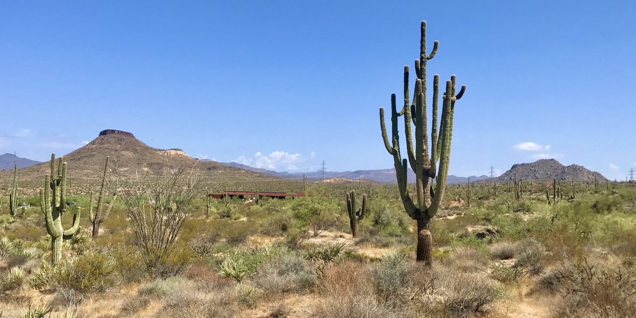
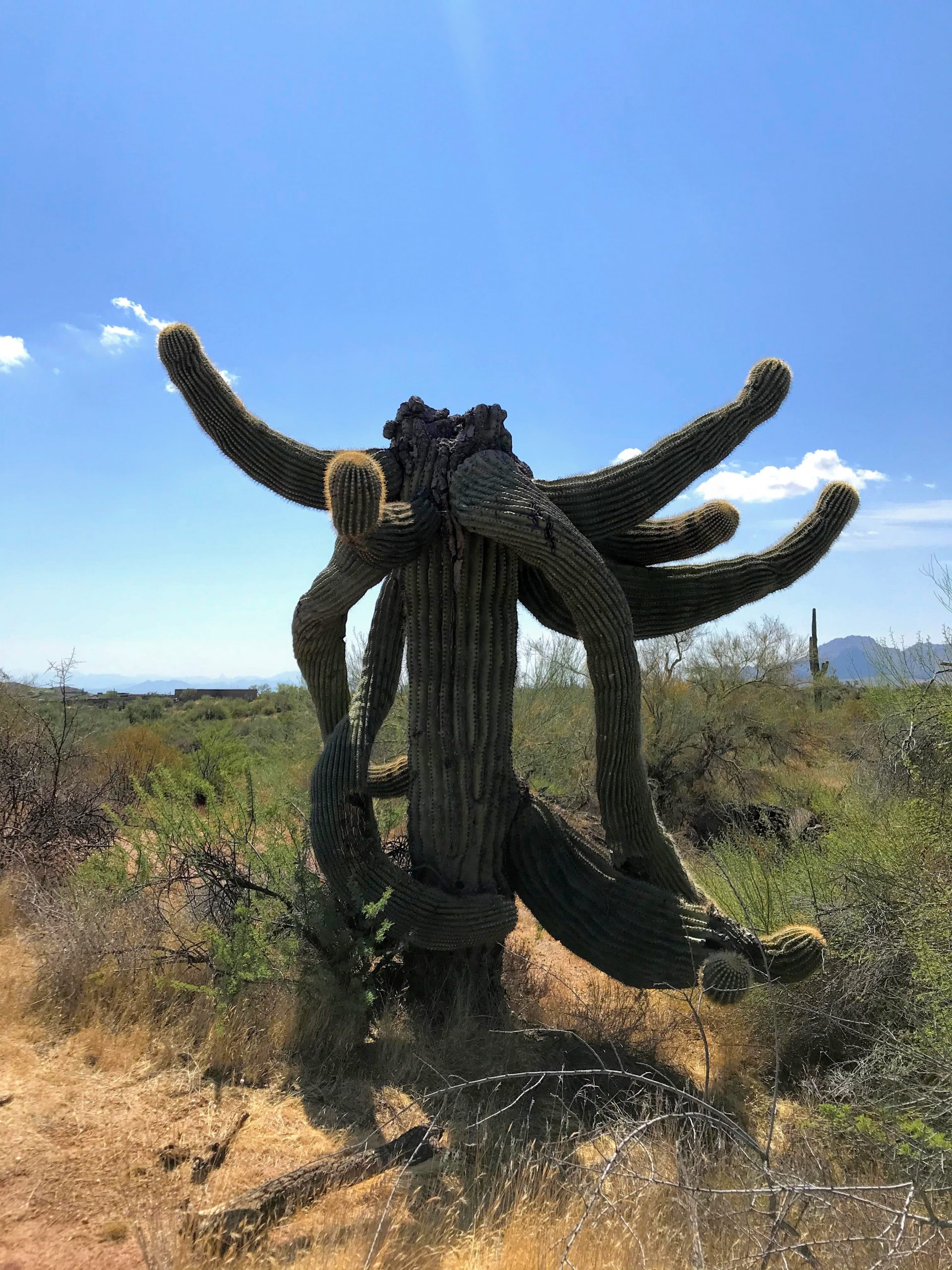
3. Cool saguaro forest with all kinds of funky shaped saguaros

4. Fun windy trail with lots of ups and downs

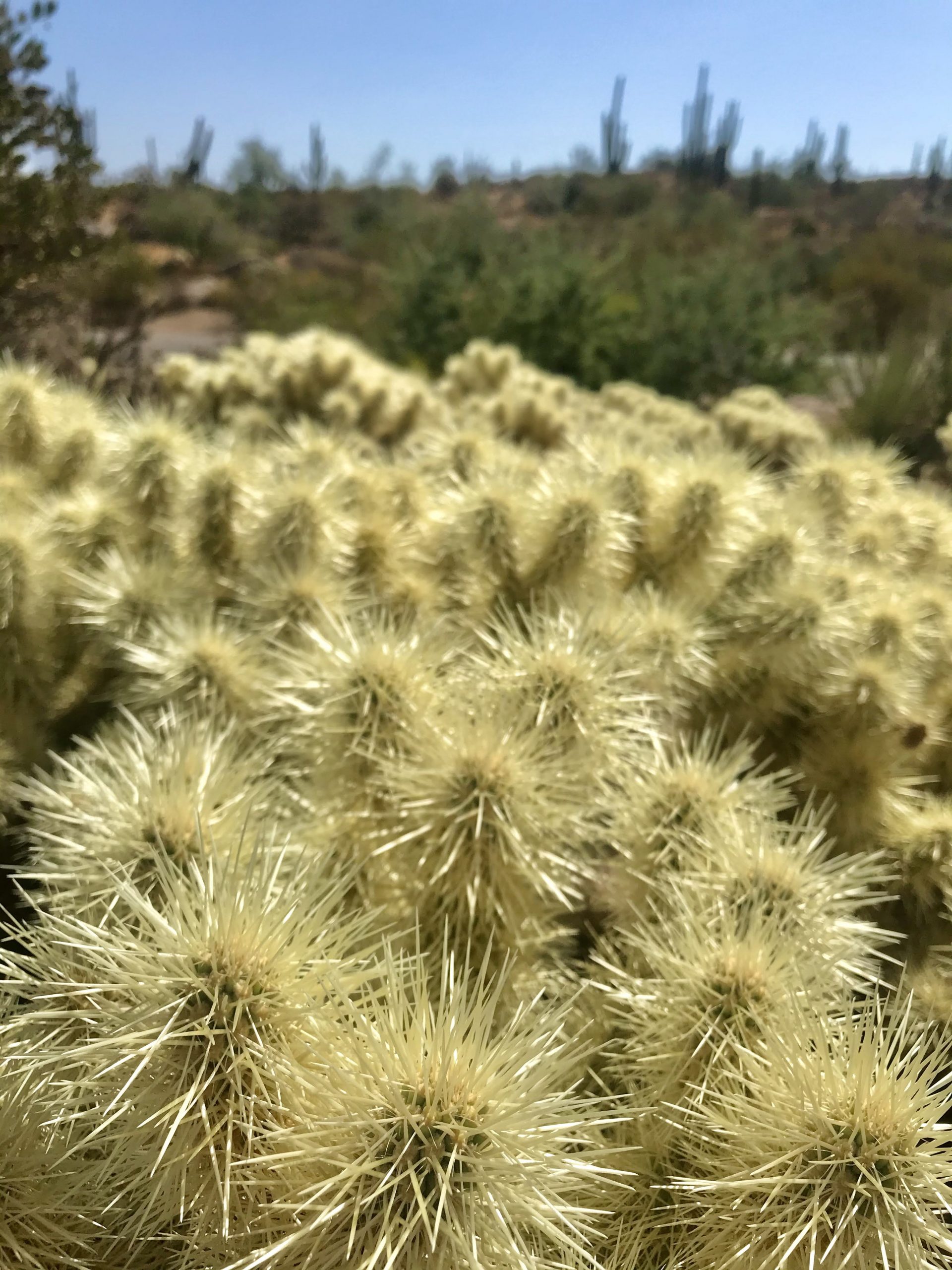
5. Great desert plants (huge variety of chollas!)

6. Big boulders to look at

7. It’s flat and easy, making it great for those hot days

The Chuckwagon trail is meh. It follows the powerlines back to the trailhead but is better than being on the powerline road. If you like loops (like we do) then take the Chuckwagon back. Or you could walk back on the Latigo trail for a nice out and back.

So, should you do the Latigo Chuckwagon Loop Hike?

Yup, this is a really nice area and hike. Your brain and body will thank you!

Other hikes close by

So many options from the Brown’s Mountain Trailhead! You could try hiking to Brown’s Ranch or around Brown’s Mountain. Bring your map and make a loop that suits how you are feeling that day. Head over to the Fraesfield trailhead and try the Whiskey Bottle Trail Hike. The Granite Mountain Trailhead is just 10 minutes down the road and has great options: 136th St Express trail, or make a loop with 136th St Express trail and the Cowpoke trail, or walk around Granite Mountain!

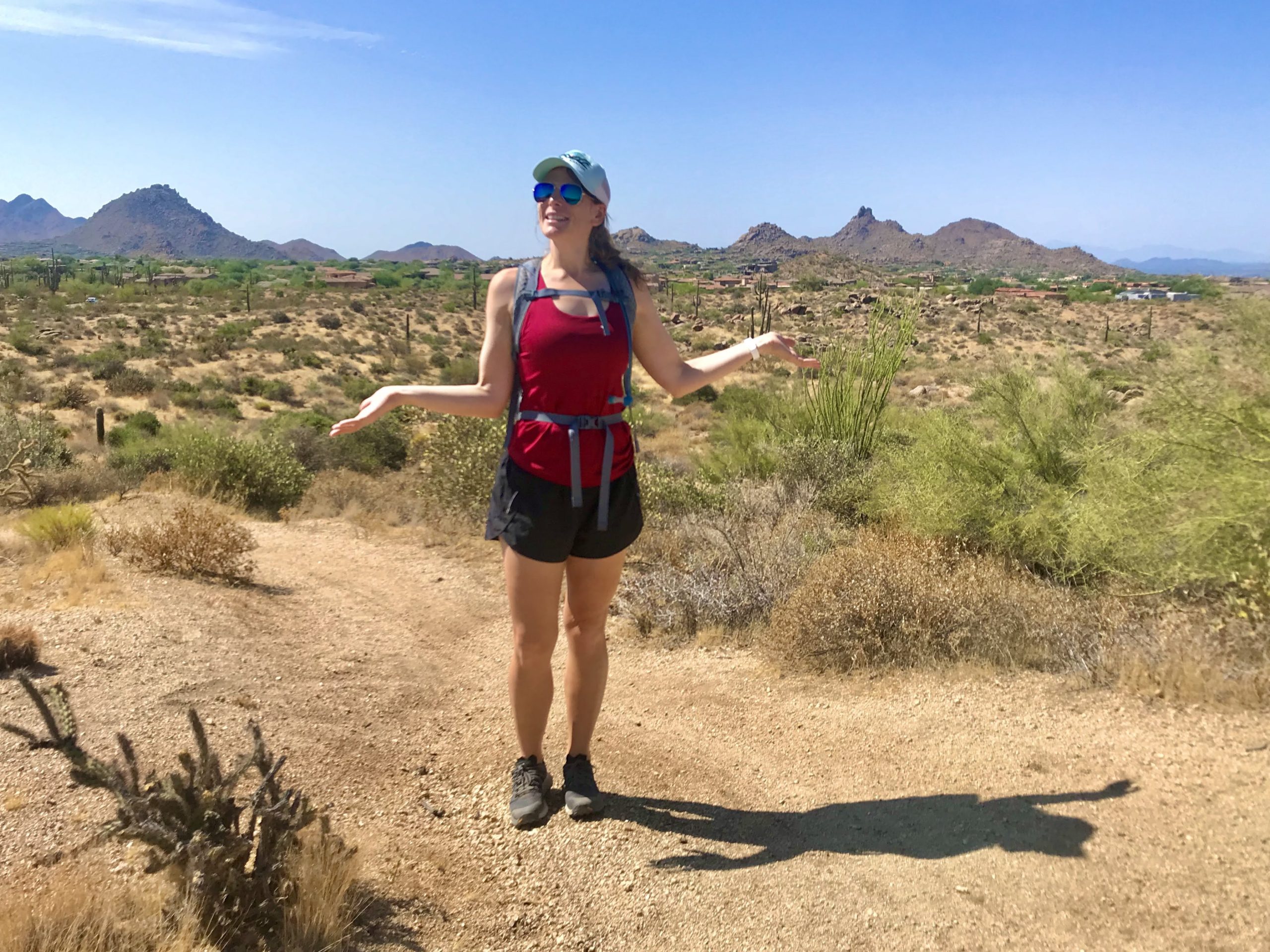
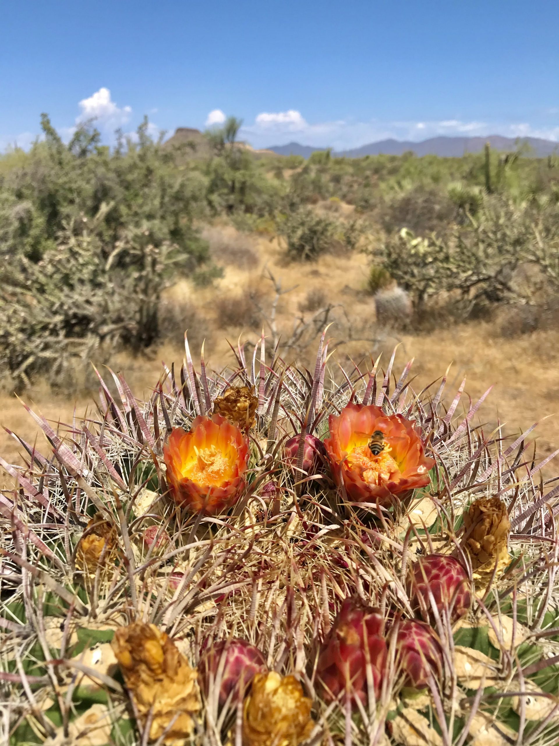
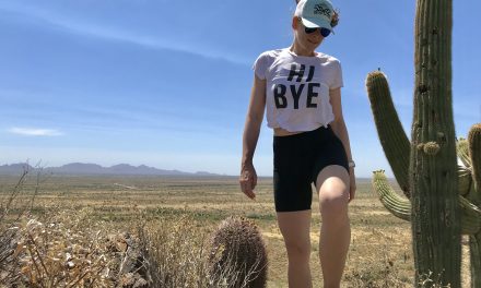
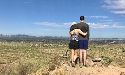
Photos that will make you want to go there:

Get more inspired to get outside:

PCT Trail Journal: Day 14 Mile 146.1 to Paradise Valley Cafe (Mile 151.8)

6.21909 up873 downIdyllwild Airbnb151.82 Hours 4 MinutesIdyllwild and town food!I start out with big hunger and then can't eat everythingPCT Trail Journal: Day 14 Mile 146.1 to Paradise Valley Cafe (Mile 151.8) On day 14 of the PCT (mile 146.1 to Paradise Valley...

PCT Trail Journal: Day 13 Miles 131.6 to 146.1

15.612405 up2336 downMile 146.1146.16 Hours 11 MinutesThe wildflowers 🌼🌼🌼Need larger battery pack ASAP!PCT Trail Journal: Day 13 Miles 131.6 to 146.1 Miles 131.6 to 146.1 on the PCT were good and hot filled with more wildflowers than you could imagine. There was a lot...

PCT Trail Journal: Day 12 Miles 115.4 to 131.6

16.033291 up1906 downMile 131.6131.65 Hours 50 MinutesListening to my book while hikingI am quite dirty. So dirty that bandaids and tape won't stick to my skin. PCT Trail Journal: Day 12 Miles 115.4 to 131.6 Miles 115.4 to 131.6 were both hard and gave me a sense of...

PCT Trail Journal: Day 11 Miles 104.8 to 115.4

13.531519 up1513 downMile 115.4115.44 Hours 56 MinutesWalking through field after field of wildflowers I don't need 10 bars per day and should focus on the base meals in resupply boxesPCT Trail Journal: Day 11 Miles 104.8 to 115.4 Miles 104.8 to 115.4 on the PCT were...

PCT Trail Journal: Day 10 3rd Gate Water Cache to Mile 104.8 (Miles 91.2 to 104.8)

13.631558 up1611 downMile 104.8104.84 Hours 27 MinutesThe wildflowers and trail magic!Trail magic is awesome but I already knew that. I need to take more breaks and do shorter days. PCT Trail Journal: Day 10 3rd Gate Water Cache to Mile 104.8  Day 10 from 3rd Gate...

PCT Trail Journal: Day 9 Scissors Crossing to 3rd Gate Water Cache (Mile 77.1 to 91.2)

14.012211 up1043 down3rd Gate Water Cache91.24 Hours 57 MinutesThe trail and finding new hiking friends!I drink a lot of water. Need to be smart about water sources especially in these drier sections.PCT Trail Journal: Day 9 Scissors Crossing to 3rd Gate Water Cache ...

PCT Trail Journal: Day 7 & 8 Double Rest Day at Stagecoach

00 up0 downSheep Shed @ Stagecoach RV Resort76.30Day 7: Having a chill day at Stagecoach and getting new shoes! Day 8: Hanging in Julian with Hannah, Jorrit and Liam 💗Day 7: Use padded moleskin around a blister to relieve some of the pressure on the blister Day 8:...

PCT Trail Journal: Day 6 mile 68.4 to Stagecoach RV Resort (mile 68.4 to 76.3)

7.85738 up 2231 downStagecoach RV Resort76.33 hours 7 minutesThe best part was that it was a good day  Taking it easy is good for me.PCT Trail Journal: Mile 68.4 to Stagecoach RV Resort (mile 68.4 to 76.3) Town day means wake early and hike day. Your girl was up...

PCT Trail Journal: Day 5 Mile 56.2 to 68.4

12.341247 up 2759 downMile 68.468.45 hours 2 minutes⛰Nice sections of trail with great mountain views 🌼Lots of wildflowers as I got lower    Feet must be fixedPCT Trail Journal: Mile 56.2 t0 68.4 Overview Wow super rough day. My feet are in terrible shape....

PCT Trail Journal: Day 4 Mt Laguna to Mile 56.2 (Miles 48.7 to 56.2)

15.001837 up2526 downMile 56.256.25 hours 55 minutesThe section of the trail past the picnic area on the edge of a mountain with great desert views  ✨Need to take better care of my feet✨Need to take breaksPCT Trail Journal: Mt Laguna to Mile 56.2 (Miles 48.7 to...