3.7 Miles

586 feet

Easy/Medium

A Views

Forest Road 2076 Hike Overview

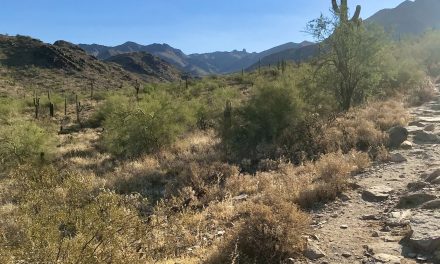
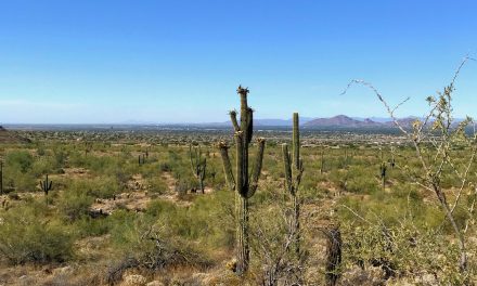
The Forest Road 2076 hike is located off of Bartlett Dam Road (FR 205). It is blocked off to off-road vehicles and is very infrequently traveled. This means you will have the place to yourself. As you start climbing out of the wash there will be big views of the McDowells! There are signs for FR 2076 but it is not very well marked. It’s in a wash but you could wander off. Hike this only if you are comfortable making your own trail with the low likelihood you will see another hiker. 

Map & Elevation Profile

Total distance: 3.73 mi
Max elevation: 3231 ft
Min elevation: 2645 ft
Total time: 01:21:26

Map for Forest Road 2076 in the Tonto National Forest

This map will give you an overview of Forest Road 2076 and the wash. 
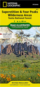
Nat geo 851 superstition and 4 peaks wilderness area map

Nat Geo map #851

Superstition and Four Peaks Wildnerness Area Map. Great overview map of the area (affiliate link).

Parking

As you are driving towards Barlett Dam on Barlett Dam Road (FR 205), you will descend into a wash. That’s where you park. Look for FR 413 and other cars pulling ATV trailers parked. This is a popular area to drive off-road vehicles.  The entrance is on the north side of the road and you will see big gates blocking off the wash (so folks can’t drive in it).

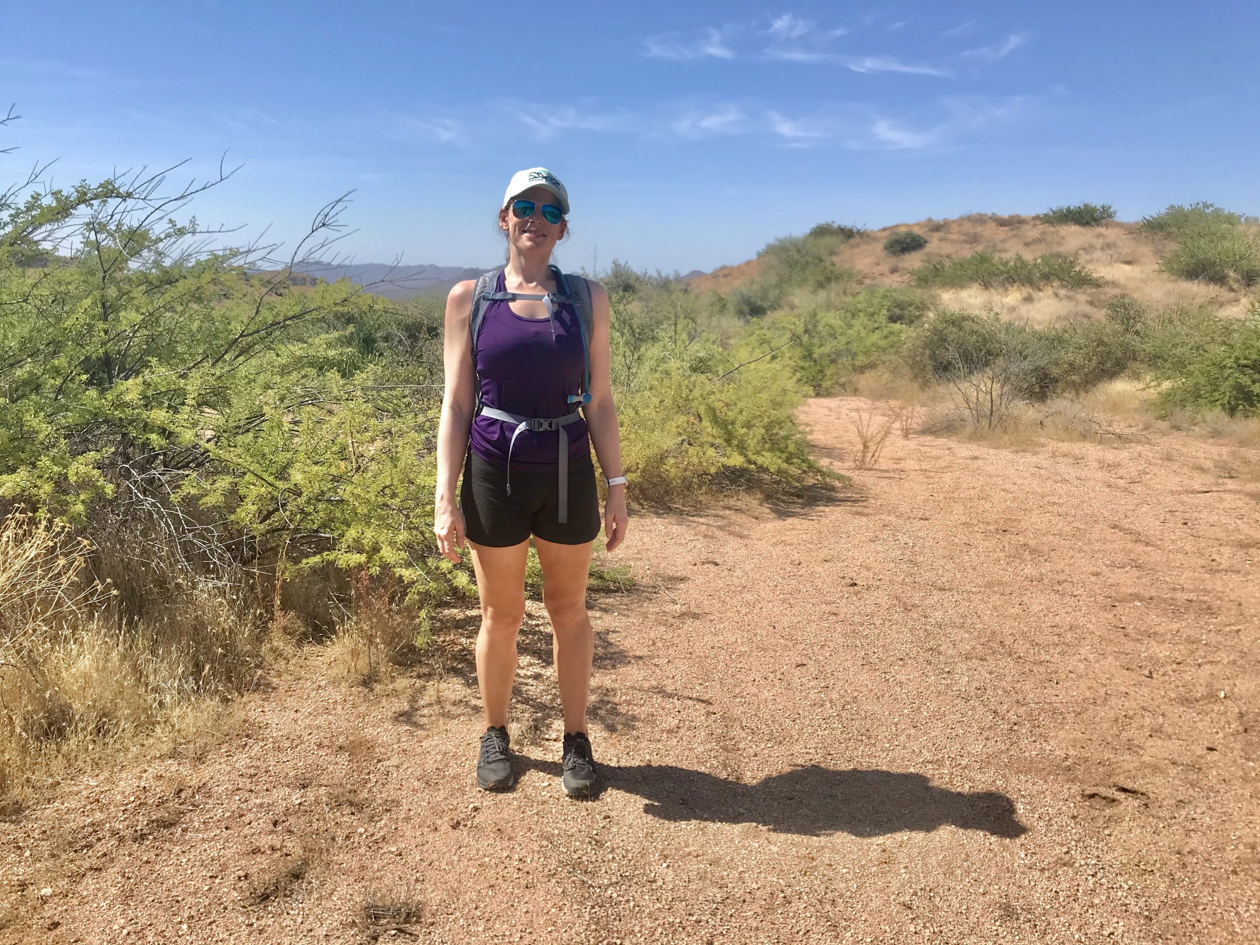
Forest Road 2076 Hike Trail Notes

We got a late start (i.e. slept in) and wanted to hike somewhere on the north side of the McDowell Sonoran Preserve. We drove on the northern border but didn’t find anywhere to stop and park.

So this is how we ended up on Barlett Dam Road. By this time it was already 9:30 am, super hot, and we didn’t really have a plan on where to hike. 

Forest Road 413 was marked on the map and knew this is a popular spot for ATVs. The BF said let’s just hike here.

I was not impressed and didn’t want to hike on a road that ATVs would be tearing through. Then we noticed that Forest Road 413 extends to the north and is blocked off to vehicles. And that’s the story of how we decided to hike on Forest Road 2076.

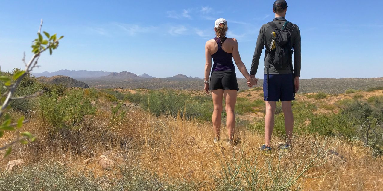
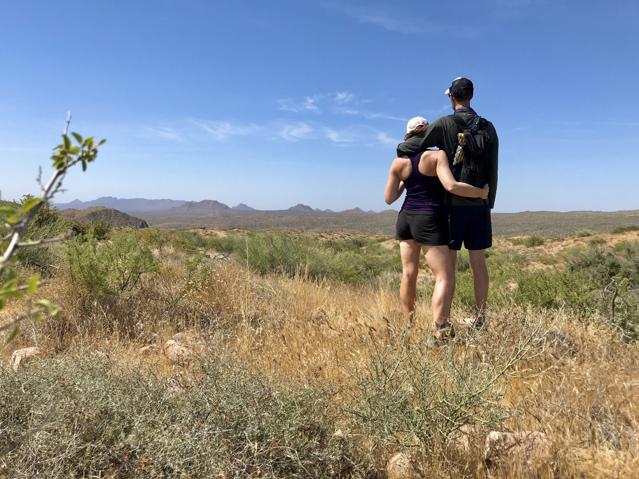
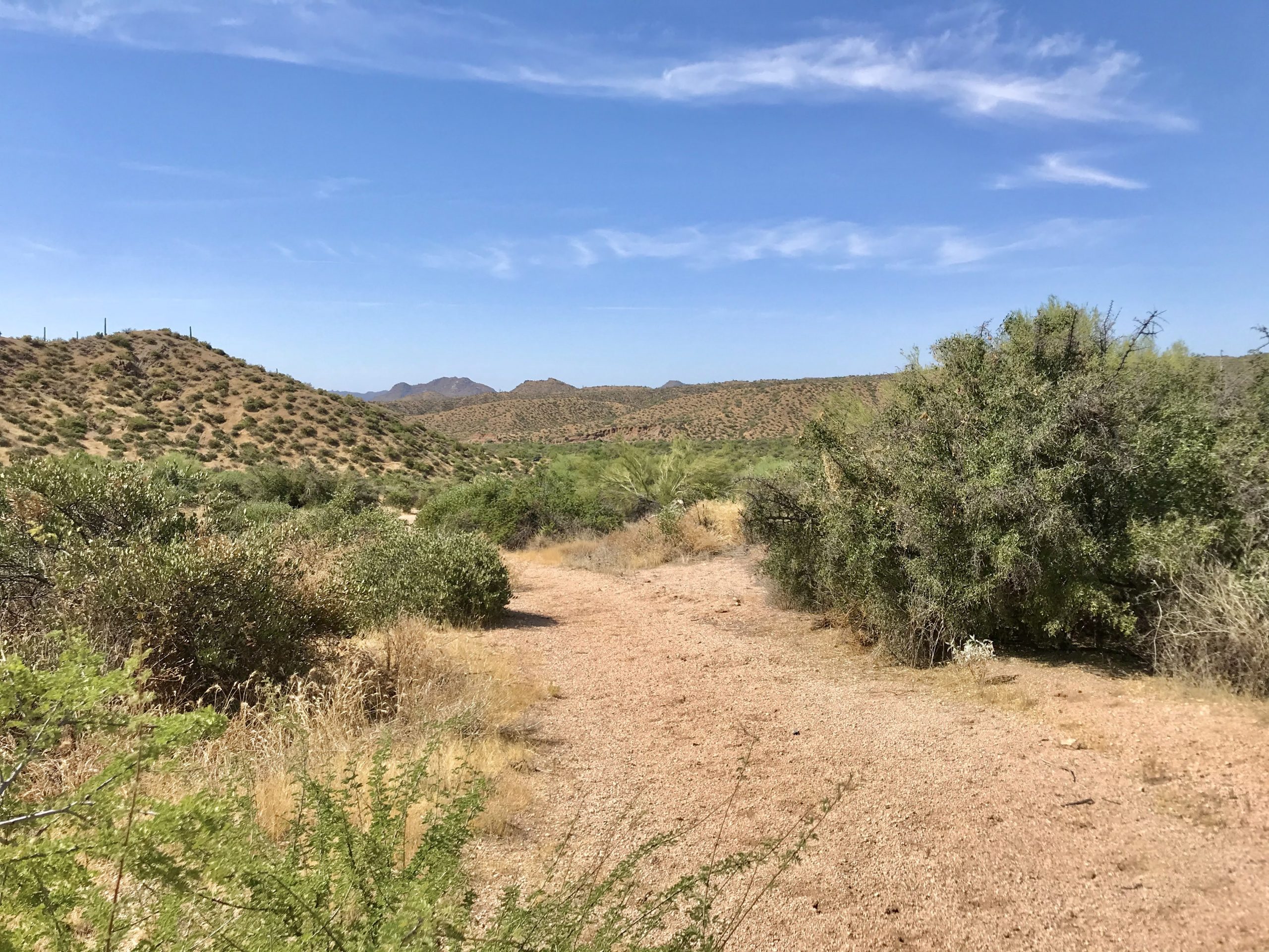
You start in a wash and it is pretty underwhelming. As you climb up the views get better and better. This hike really grew on me and I felt bad for thinking such negative thoughts about it. 

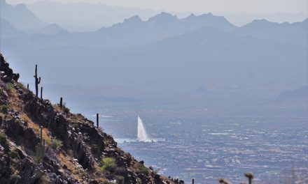
There are spectacular views here! We picked out a ton of great camping spots so we can come back here with a tent. 

If you are looking for solitude it doesn’t get much better than this 👍.

So, is hiking on Forest Road 2076 worth it?

Are you looking for solitude, great views, and maybe a place you haven’t hiked before? This may be it! Forge your own path and enjoy the views. 

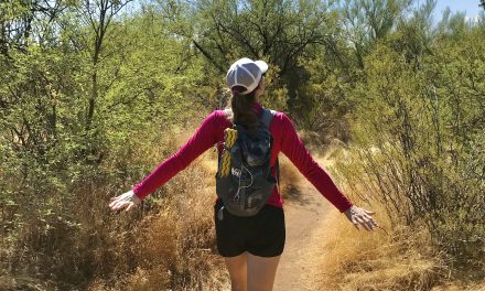
Photo Gallery to make you want to go there:

Get more inspired to get outside:

PCT Trail Journal Day 37: Messenger Flats Campground to Mile 415.1

15.692762 feet up2421 feet down Mile 415.1 (the best campsite!)381.66 hours 7 minutes🌞Getting pizza delivered to the fire station👉Chatting with NOBOs is a great way to get the intel on the trailMay 18, 2023 PCT Trail Journal: Day 37 Messenger Flats Campground To Mile...

PCT Trail Journal: Day 36 Mile 440.2 to Messenger Flats Campground

10.243802 feet up699 feet down Messenger Flats Campground366.35 hours 9 minutes🌞Completing the up and ice cream trail magic👉I like not being rushed in the morningMay 17, 2023 PCT Trail Journal: Day 36 Mile 440.2 Messenger Flats Campground Day 36 on the PCT from Mile...

PCT Trail Summary: Week 5 Mile 549.0 to 49ers Saloon

PCT Trail Summary: Week 5 Mile 540.0 to 49ers Saloon Dates Hiked May 8 - May 14, 202396.012,460 feet up16,067 feet down38 Hours 21 Minutes💛Being warm again 💛Surviving the aqueduct and hiking it when it was cold(er) 💛Getting a trail family and them motivating me! 💛 So...

PCT Trail Summary Week 4: Walker Pass to Mile 549.0

PCT Trail Summary: Week  4 Walker Pass to Mile 549.0 Dates Hiked May 1 - May 7, 202397.1 19,527 feet up18,593 feet down36 Hours 04 Minutes💛The views, wildflowers, & Joshua Trees 💛Other hikers 💛Rest day in TehachapiFinally making it to Tehachapi and getting warm. I...

PCT Trail Journal Day 35: Vasquez Rocks to Mile 440.2

13.652323 feet up2172 feet down Mile 440.2356.16 hours 21 minutes🌞Coffee from the grocery store. And watching a tortoise eating salad for breakfast👉My new insoles seem pretty ok. May 16, 2023 PCT Trail Journal: Day 35 Vasquez Rocks to Mile 440.2 Day 35 on the PCT from...

PCT Trail Journal Days 33 & 34: Accidental Double Zero in Serenity Oasis & 49ers Saloon

00Serenity Oasis & 49ers Saloon342.90 minutes🌞Margaritas & chilling at the mobile 2 Foot adventures👉My feet didn't hurt at all today. Probably because I wasn't hiking. 👉Be careful when cutting insoles. You don't want to grab the wrong foot. May 14 & 15,...

PCT Trail Journal Day 32: Mile 471.4 to Serenity Oasis

16.032464 feet up3524 feet downSerenity Oasis342.96 hours 53 minutes🌞Getting to Serenity Oasis and margaritas!👉It's getting hot out! Going to have to start taking siestas during the dayMay 13, 2023 PCT Trail Journal: Day 31 Mile 471.4 to Serenity Oasis Day 31 on the...

PCT Trail Journal Day 31: Lake Hughes Road to Mile 471.4

14.872303 feet up1644 feet downMile 471.4326.2 5 hours 50 minutes🌞Late start (9:45 am), ice cream from the Green Valley Market and a long break👉Poisonous plants suckMay 12, 2023 PCT Trail Journal: Day 31 Lake Hughes Road to Mile 471.4 Mentally day 31 from Lake Hughes...

PCT Trail Journal Day 30: Bear Camp to Lake Hughes Road

19.261722 feet up4068 feet downLake Hughes Road312.07 hours 38 minutes🌞Chilling by the beautiful stream at the end of the day👉I need shorter mileage days. Today didn't feel good.May 11, 2023 PCT Trail Journal: Day 30 Bear Camp to Lake Hughes Road Let me start by...

PCT Trail Journal Day 29: Hikertown to Bear Camp

13.663937 feet up1591 feet downBear Camp (Mile 504.6)293.05 hours 59 minutes🌞Getting breakfast at Neenach market and getting up that huge hill👉Going uphill is hardMay 10, 2023  PCT Trail Journal: Day 29 Hikertown to Bear Camp On day 29 of the PCT, I slept until about...