4 Miles

188 feet

Easy

A+++ Views

Saguaro Nest Trail Hike Overview

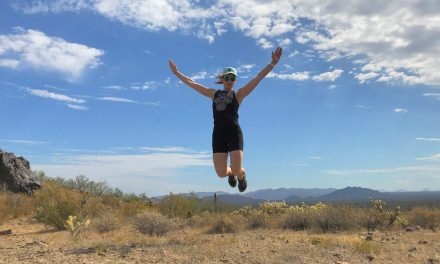
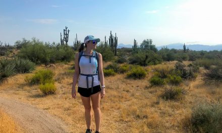
There is so much to look at on the Saguaro Nest Trail hike! Mountains galore. Make this hike as short or as long as you want. There is minimal elevation, making it a great hot weather hike. This prime Sonoran desert hiking. It’s beautiful, relaxing, and will make you feel great afterwards.

Map & Elevation Profile

Total distance: 3.99 mi
Max elevation: 2648 ft
Min elevation: 2460 ft
Total time: 01:23:49

Map for the Saguaro Nest Trail Hike

Get this map! It’s a good idea to have this guy with you in case you want to go further, explore a new trail or get turned around!

mcdowell mountains green trails map get outdoors get happy

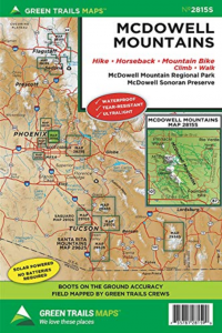
McDowell Mountains Greentrails map

You definitely won’t regret having this map for your McDowell Sonoran Preserve hikes!

Parking

We parked on N 128th street along the road and later learned we weren’t supposed to park there. Whoops! According to the map, you should park at Tom’s Thumb trailhead or the Fraesfield trailhead.

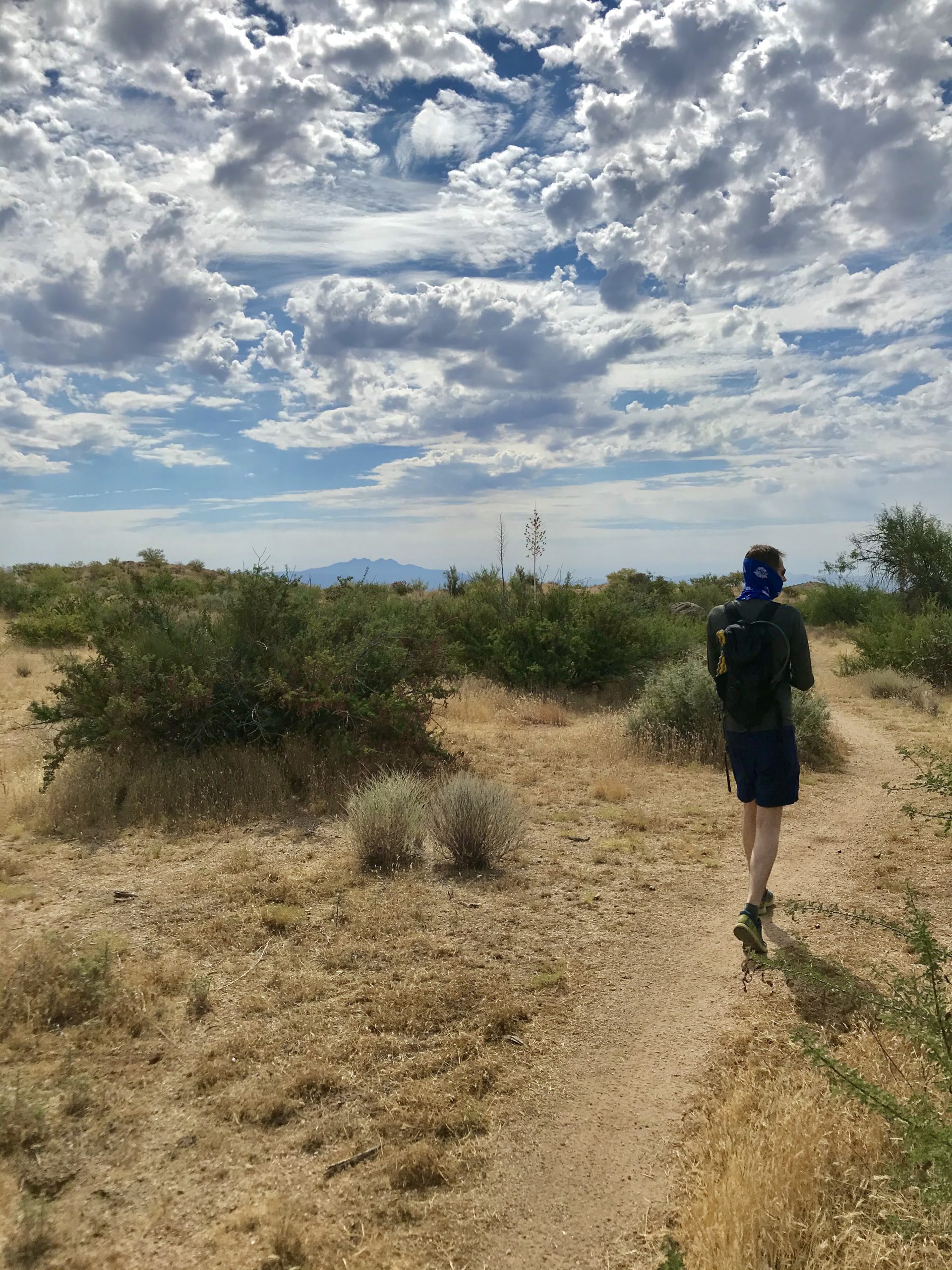
Saguaro Nest Trail Hike Trail Notes

This area is so peaceful! It is quiet and beautiful. If you are looking for a nice chill hike to recharge, give this area a try. We only saw one mountain biker and one unicyclist mountain biker (it was crazy and awesome!).

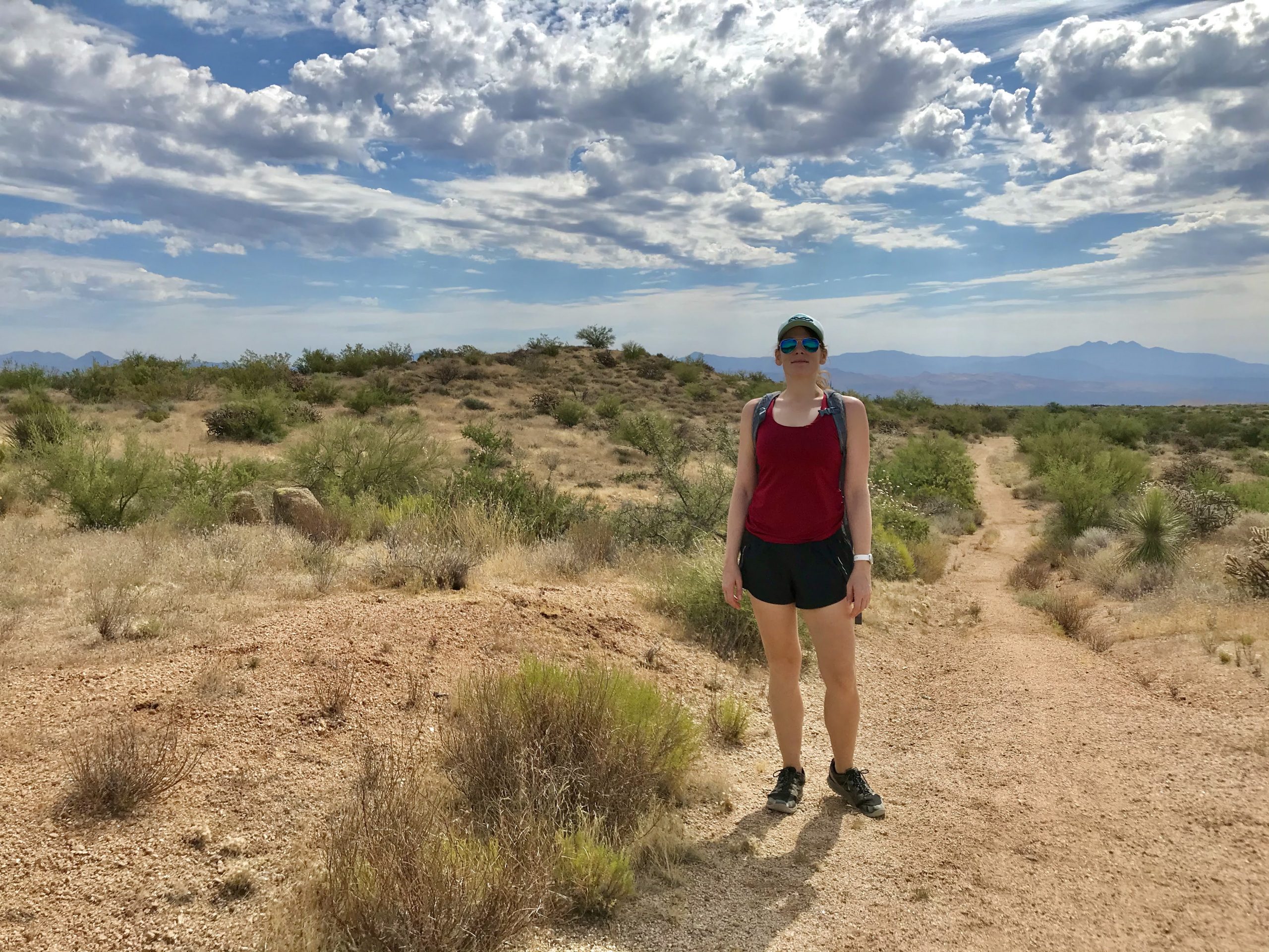
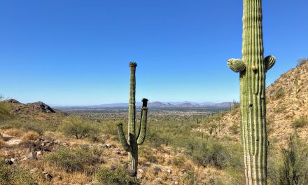
Expect 360-degree mountain views and no powerlines (unlike at Brown’s Mountain). If you love the unobstructed mountain views like me, you will love this hike!

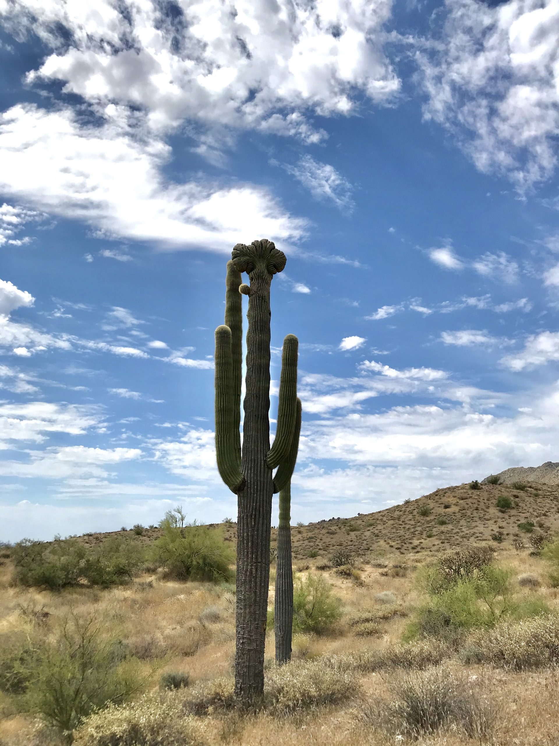
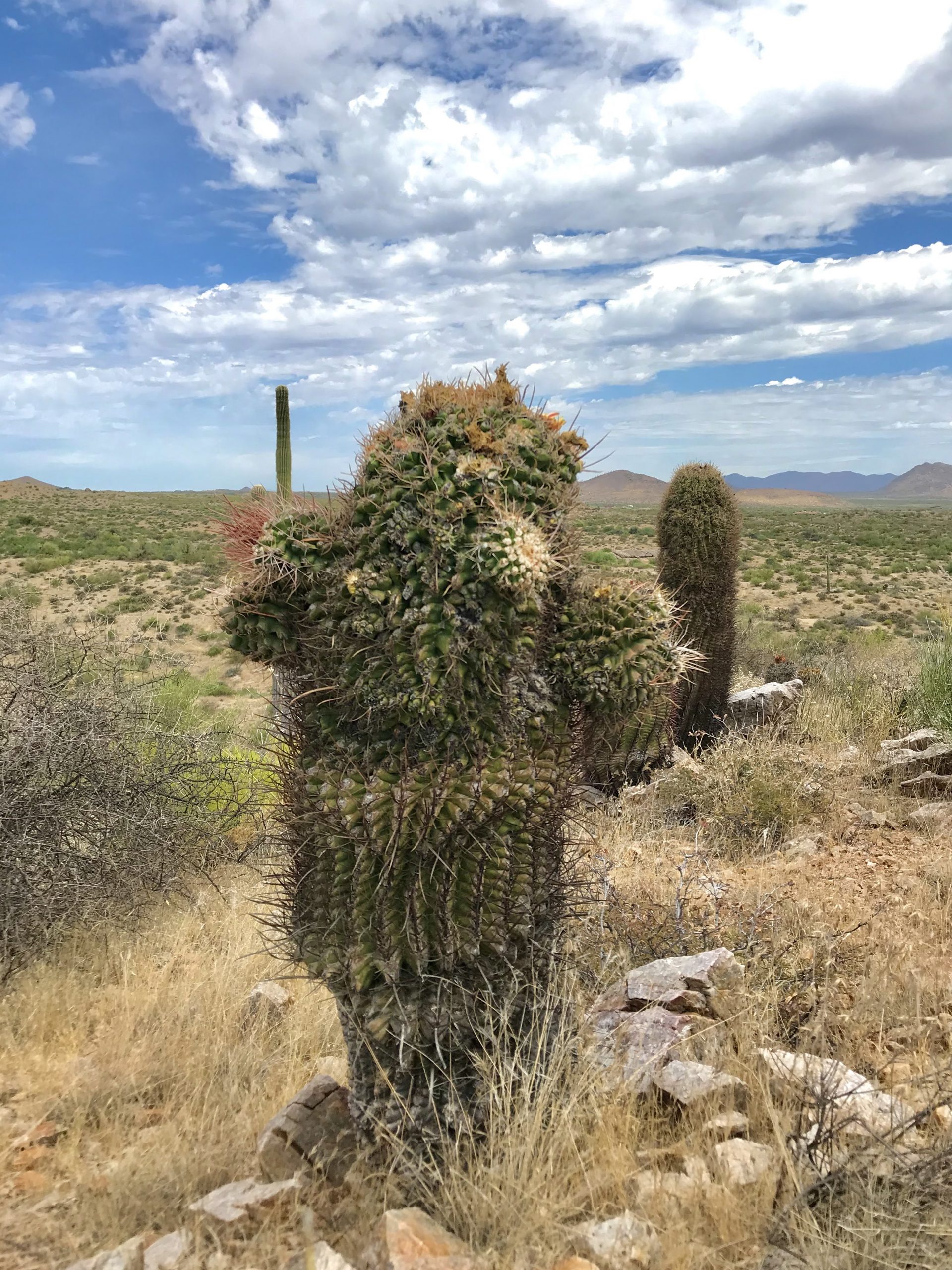
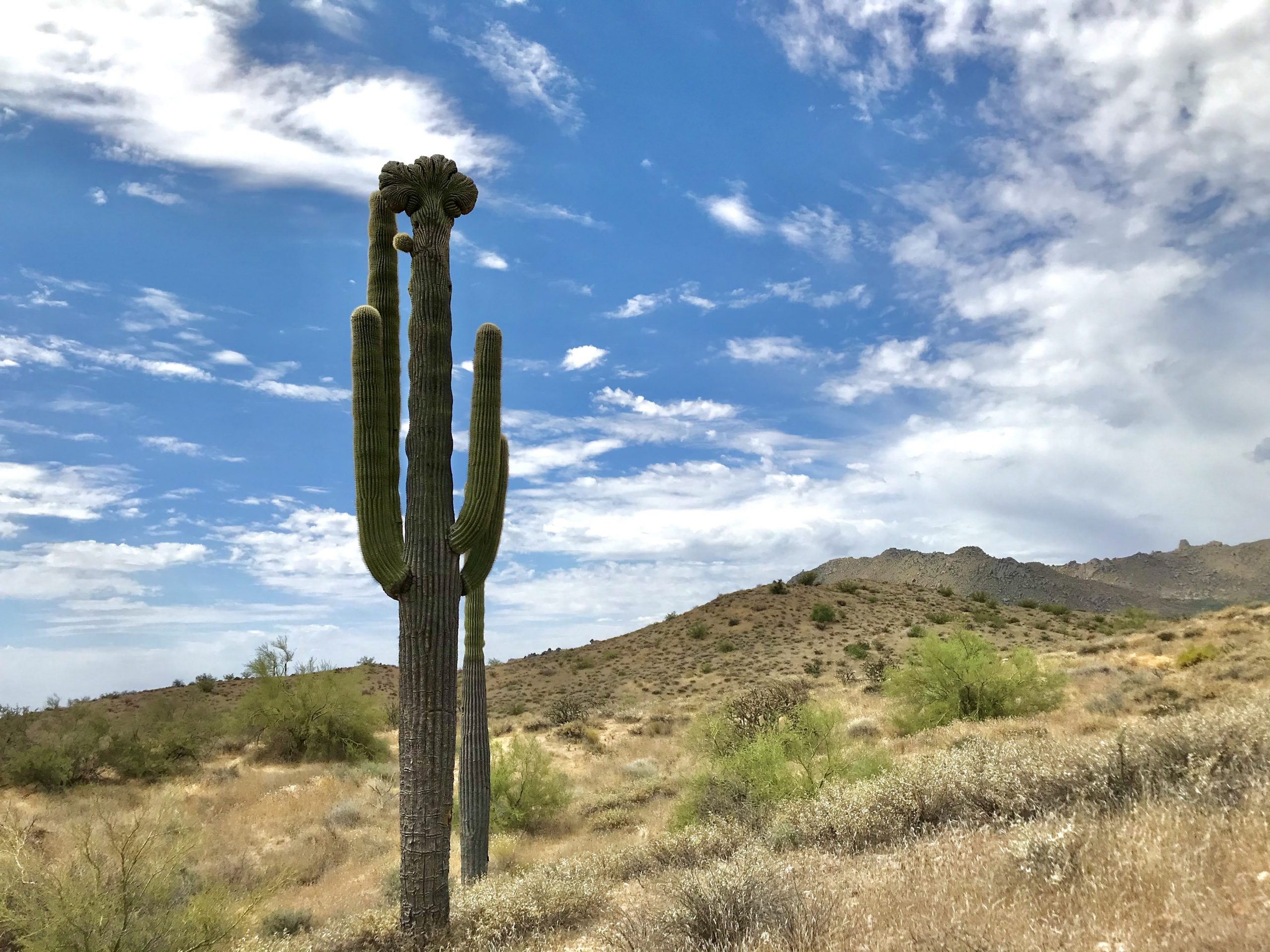
There are lots of little ups and downs without it being too difficult. It’s a great hot weather option (it’s 3 degrees cooler than down in the low valley!) when you need to get some outdoor time in. This area has all the classic desert plants as well. Check out the photos below of a crested saguaro and a weird barrel cactus. You’ll likely see wildlife as well! We saw roadrunners, bunnies, and deer.

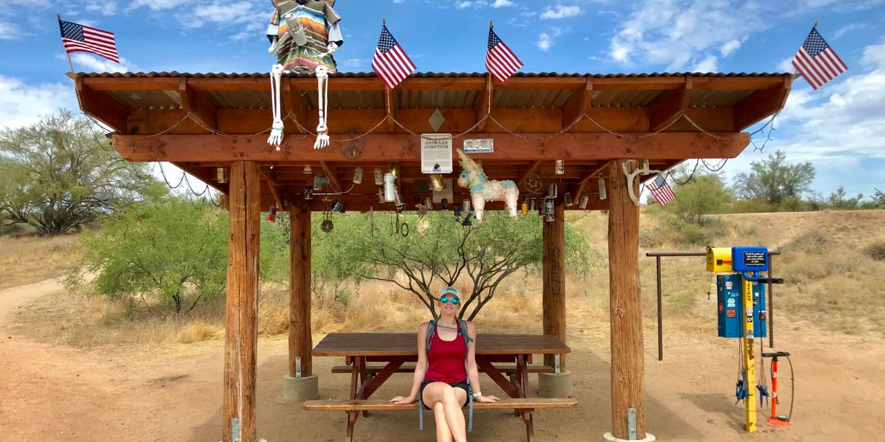
When you cross over into the McDowell Mountain Regional Park, you’ll find Jackass Junction (see featured image at the top). It’s a great little stop with supplies to fix a flat or grab a snack. It’s an awesome reminder that people and being outside is good!

So, is the Saguaro Nest Trail hike worth it?

It would probably make sense to spend days and days walking around here. You will definitely get that ‘ahhh, that was so nice’ feel afterwards. You’ll feel happy that you went out there!

Other hikes close by

Check out the Whiskey Bottle Trail hike at the Fraesfield trailhead or hike around Brown’s Mountain (it’s one of the most scenic mountains in this area, IMO!).

Get more inspired to get outside:

PCT Trail Journal Day 37: Messenger Flats Campground to Mile 415.1

15.692762 feet up2421 feet down Mile 415.1 (the best campsite!)381.66 hours 7 minutes🌞Getting pizza delivered to the fire station👉Chatting with NOBOs is a great way to get the intel on the trailMay 18, 2023 PCT Trail Journal: Day 37 Messenger Flats Campground To Mile...

PCT Trail Journal: Day 36 Mile 440.2 to Messenger Flats Campground

10.243802 feet up699 feet down Messenger Flats Campground366.35 hours 9 minutes🌞Completing the up and ice cream trail magic👉I like not being rushed in the morningMay 17, 2023 PCT Trail Journal: Day 36 Mile 440.2 Messenger Flats Campground Day 36 on the PCT from Mile...

PCT Trail Summary: Week 5 Mile 549.0 to 49ers Saloon

PCT Trail Summary: Week 5 Mile 540.0 to 49ers Saloon Dates Hiked May 8 - May 14, 202396.012,460 feet up16,067 feet down38 Hours 21 Minutes💛Being warm again 💛Surviving the aqueduct and hiking it when it was cold(er) 💛Getting a trail family and them motivating me! 💛 So...

PCT Trail Summary Week 4: Walker Pass to Mile 549.0

PCT Trail Summary: Week  4 Walker Pass to Mile 549.0 Dates Hiked May 1 - May 7, 202397.1 19,527 feet up18,593 feet down36 Hours 04 Minutes💛The views, wildflowers, & Joshua Trees 💛Other hikers 💛Rest day in TehachapiFinally making it to Tehachapi and getting warm. I...

PCT Trail Journal Day 35: Vasquez Rocks to Mile 440.2

13.652323 feet up2172 feet down Mile 440.2356.16 hours 21 minutes🌞Coffee from the grocery store. And watching a tortoise eating salad for breakfast👉My new insoles seem pretty ok. May 16, 2023 PCT Trail Journal: Day 35 Vasquez Rocks to Mile 440.2 Day 35 on the PCT from...

PCT Trail Journal Days 33 & 34: Accidental Double Zero in Serenity Oasis & 49ers Saloon

00Serenity Oasis & 49ers Saloon342.90 minutes🌞Margaritas & chilling at the mobile 2 Foot adventures👉My feet didn't hurt at all today. Probably because I wasn't hiking. 👉Be careful when cutting insoles. You don't want to grab the wrong foot. May 14 & 15,...

PCT Trail Journal Day 32: Mile 471.4 to Serenity Oasis

16.032464 feet up3524 feet downSerenity Oasis342.96 hours 53 minutes🌞Getting to Serenity Oasis and margaritas!👉It's getting hot out! Going to have to start taking siestas during the dayMay 13, 2023 PCT Trail Journal: Day 31 Mile 471.4 to Serenity Oasis Day 31 on the...

PCT Trail Journal Day 31: Lake Hughes Road to Mile 471.4

14.872303 feet up1644 feet downMile 471.4326.2 5 hours 50 minutes🌞Late start (9:45 am), ice cream from the Green Valley Market and a long break👉Poisonous plants suckMay 12, 2023 PCT Trail Journal: Day 31 Lake Hughes Road to Mile 471.4 Mentally day 31 from Lake Hughes...

PCT Trail Journal Day 30: Bear Camp to Lake Hughes Road

19.261722 feet up4068 feet downLake Hughes Road312.07 hours 38 minutes🌞Chilling by the beautiful stream at the end of the day👉I need shorter mileage days. Today didn't feel good.May 11, 2023 PCT Trail Journal: Day 30 Bear Camp to Lake Hughes Road Let me start by...

PCT Trail Journal Day 29: Hikertown to Bear Camp

13.663937 feet up1591 feet downBear Camp (Mile 504.6)293.05 hours 59 minutes🌞Getting breakfast at Neenach market and getting up that huge hill👉Going uphill is hardMay 10, 2023  PCT Trail Journal: Day 29 Hikertown to Bear Camp On day 29 of the PCT, I slept until about...