4.7 Miles

707 feet

Moderate

A+ Views

Gateway Loop Hike Overview

I’m obsessed with the McDowells! We live 10 minutes from the Gateway trailhead and the Gateway Loop Hike is one of our go-to hikes. So beautiful, close to the city, and superb views!

Map & Elevation Profile

Total distance: 4.68 mi
Max elevation: 2380 ft
Min elevation: 1673 ft
Total time: 01:31:57

Map for the Gateway Loop Hike

Get this map! The Green Trail Maps are super nice maps because they are easy to read, have good color coding, distances and elevations, and are usually up to date.

mcdowell mountains green trails map get outdoors get happy

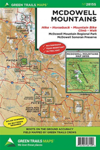
McDowell Mountains Greentrails map

You definitely won’t regret having this map for your McDowell Sonoran Preserve hikes!

Parking

Plugin ‘gateway trailhead’ and Google maps will take you right there. Parking is free!

Gateway Loop Hike Trail notes

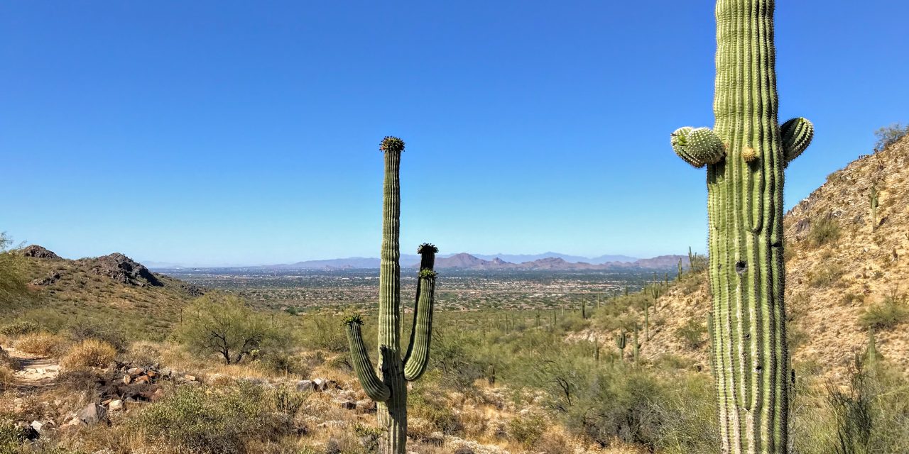
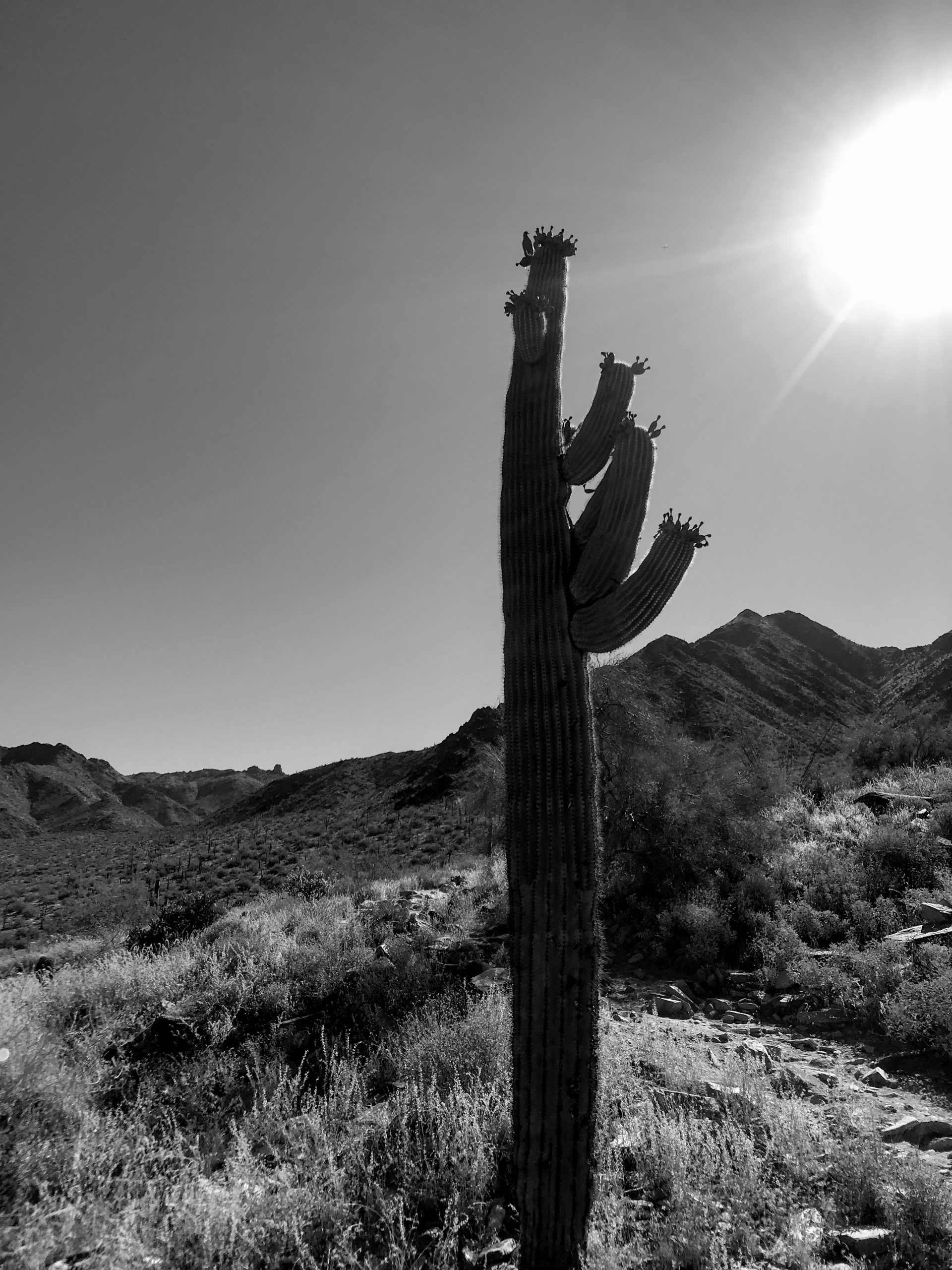
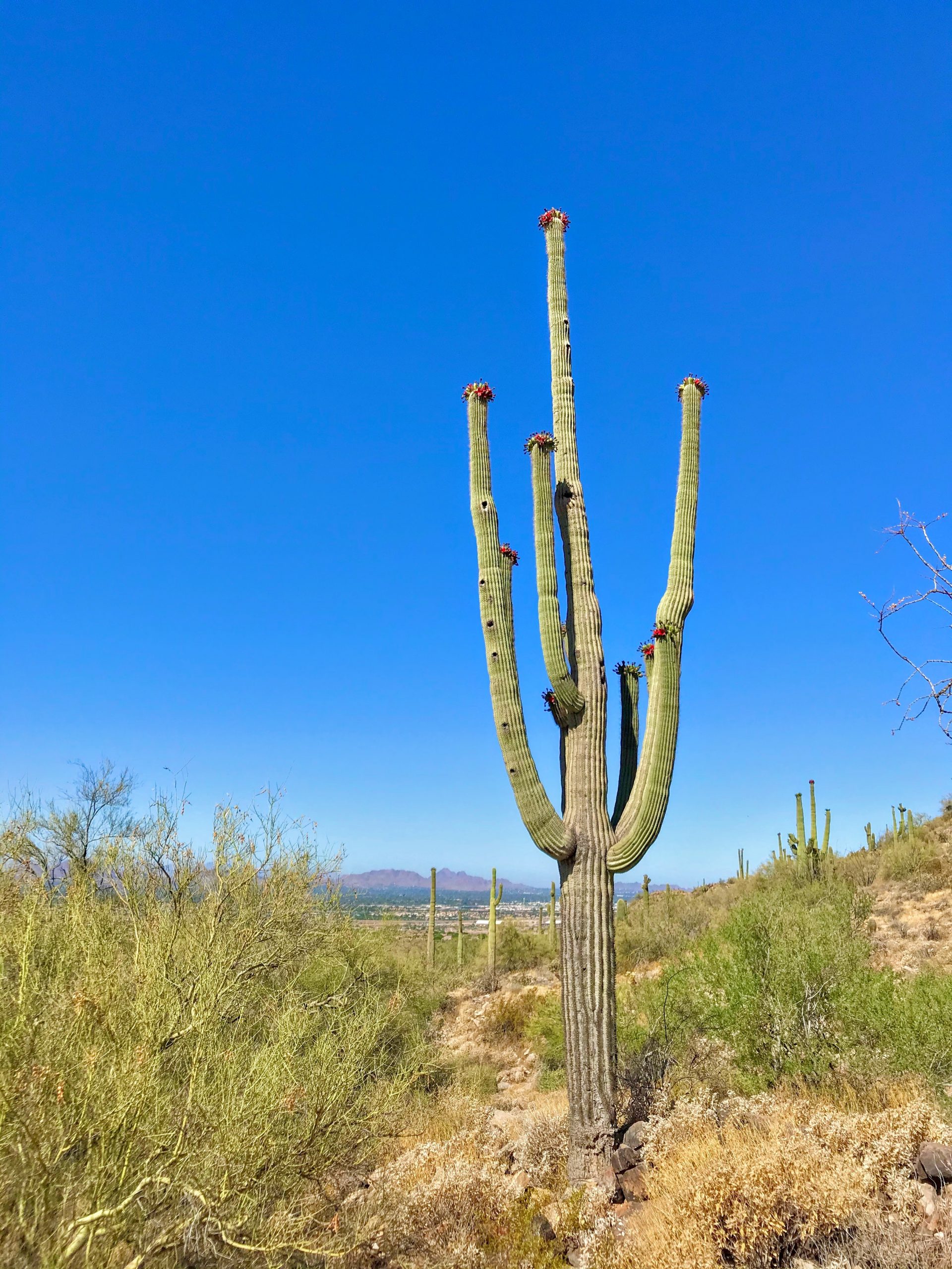
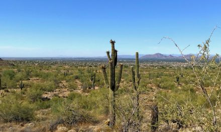
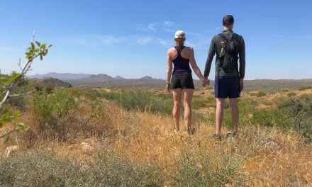
I live close by and love the Mcdowells, so I am biased. When we discovered this area, I thought wow, this is great ‘real’ hiking close to the city with a lot of free parking. The desert landscape in this part of the Mcdowells is nice with tons of saguaros and teddy bear cacti. It feels more lush compared to other hiking areas in the city like North mountain or Lookout.

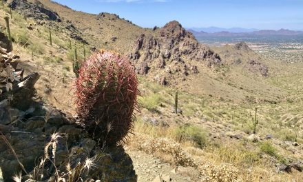
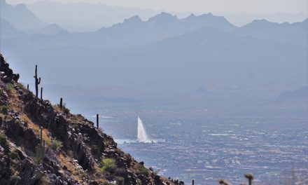
The Gateway Loop hike is a go-to hike for me. There is a little bit of elevation but it’s not going to kill you and it has great views of Camelback, the Phoenix Mountain Preserve, Lookout… I arrived at the trailhead at 8 am on a Friday morning, so it wasn’t too busy. I was back home at 9:45 am and ready to get started working. Definitely do this hike clockwise. The views coming down the saddle are way better if going clockwise (in my opinion!).

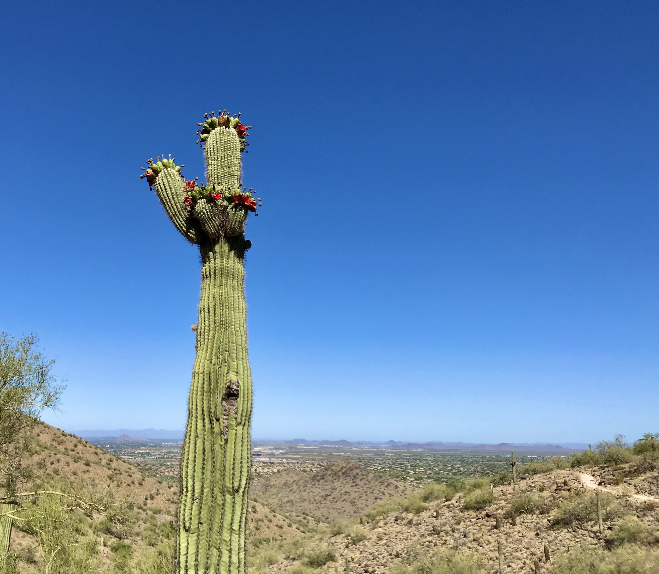
The best part was that the saguaro fruits were bursting open and starting to look like flowers. Plus the birds were going to town on them. Check what others are saying about this trail here.

So, was is the Gateway loop hike worth it?

Yep, definitely. This area is such a gem!

Other hikes close by

There are so many options close by! For something harder with more elevation, check out the Bell Pass Hike. For something more chill, mosey on up to the Fraesfield trailhead and try the Whiskey Bottle Trail Hike.

Get more inspired to get outside:

PCT Trail Journal: Day 21 Bird Spring Pass to Kelso Road

15.652822 feet up3287 feet down Kelso Road188.56 hours 3 minutes🌟Hiking through 5+ miles of Joshua Tree forest👉The down is really hurting my left knee.May 2, 2023  PCT Trail Journal: Day 21 Bird Spring Pass to Kelso Road The wind was howling all night. I'm glad I had...

PCT Trail Journal: Day 20 Walker Pass to Bird Spring Pass

21.114163 feet up3845 feet down Bird Spring Pass173.67 Hours 48 minutes🌟Wildflowers + Joshua Trees👉Need to be more careful with my gear so I don't destroy it all. May 1, 2023  PCT Trail Journal: Day 20 Walker Pass to Bird Spring Pass I slept ok. I woke up a lot but...

PCT Trail Journal: Day 19 Walker Pass to Walker Pass Campground

0.8836 feet up 259 feet down Walker Pass Campground152.60.3🌟Seeing my love👉Don't panic, everything will be fine. April 30, 2023  PCT Trail Journal: Day 19 Walker Pass to Walker Pass Campground Day 19 started out with a great morning with my significant other. We...

PCT Trail Journal: Days 15 – 18 Rest Days in Idyllwild & Palm Springs

00Idyllwild Airbnb & Hotel in Palm Springs151.80🌟Face mask, lotion, and a hot bath 🌟Nice comfy soft beds 👉It's ok to not hike hard on the trail all the time. 👉Planning a flip is hard and the weather should definitely be considered. 👉Being a thru-hiker means doing...

PCT Trail Summary: Week 2 Miles 68.4 to 131.6

PCT Trail Summary: Week 2 Miles 68.4 to 131.6 Dates Hiked April 17 - April 23, 202365.19,327 up8,338 down21 Hours 18 Minutes💖Seeing Kari from my hometown! 💖Resting at Stagecoach - the folks were so friendly 💖Hanging in Julian with Hannah, Jorrit and Liam 💖Hiking with...

PCT Trail Summary: Week 1 Campo to Mile 68.4

PCT Trail Summary: Week 1 Campo to Mile 68.4 Dates Hiked April 12 - April 16, 202368.411,037 up10,161 down26.9 HoursHiking with Happy6 & 20D The wildflowers 🌸 My positive mindsetOther hikers & flowers!I would listen to my body more and not suffer through so...

PCT Trail Journal: Day 14 Mile 146.1 to Paradise Valley Cafe (Mile 151.8)

6.21909 up873 downIdyllwild Airbnb151.82 Hours 4 MinutesIdyllwild and town food!I start out with big hunger and then can't eat everythingApril 25th, 2023PCT Trail Journal: Day 14 Mile 146.1 to Paradise Valley Cafe (Mile 151.8) Hiked on April 25th, 2023 On day 14 of...

PCT Trail Journal: Day 13 Miles 131.6 to 146.1

15.612405 up2336 downMile 146.1146.16 Hours 11 MinutesThe wildflowers 🌼🌼🌼Need larger battery pack ASAP!PCT Trail Journal: Day 13 Miles 131.6 to 146.1 Miles 131.6 to 146.1 on the PCT were good and hot filled with more wildflowers than you could imagine. There was a lot...

PCT Trail Journal: Day 12 Miles 115.4 to 131.6

16.033291 up1906 downMile 131.6131.65 Hours 50 MinutesListening to my book while hikingI am quite dirty. So dirty that bandaids and tape won't stick to my skin. PCT Trail Journal: Day 12 Miles 115.4 to 131.6 Miles 115.4 to 131.6 were both hard and gave me a sense of...

PCT Trail Journal: Day 11 Miles 104.8 to 115.4

13.531519 up1513 downMile 115.4115.44 Hours 56 MinutesWalking through field after field of wildflowers I don't need 10 bars per day and should focus on the base meals in resupply boxesPCT Trail Journal: Day 11 Miles 104.8 to 115.4 Miles 104.8 to 115.4 on the PCT were...